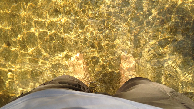
A hot day in Yosemite Valley


I went back to the Apple Store tonight. I’d been checking out people’s uploaded pictures of the store throughout the day, and saw that many more people had left their memorials at the store on this first full day after Steve Jobs’ death. I wanted to experience these, but also felt like I had unfinished business from yesterday.
So I went and stayed till midnight. Indeed, there were more people and a lot more offerings since yesterday.

My note from yesterday was nestled among all its new neighbors.

The sticky note messages were like snowfall.

Today’s visit helped. I started to settle into the habit of this new natural state of Steve Jobs. Still around, but a little differently than before. The store didn’t seem quite as gloomy as it did last night with just a few flowers and messages and a handful of people there just to photograph. Today, a proper delivery seemed to have been made. I could proceed to reflect on why this man has had such an impact on me, his lessons, and their implications for the things I want to do. I sat on a fire hydrant and ruminated.
Finally, I felt light enough, relieved enough to start to find delight in this message recalling Steve Jobs’ Pixar legacy:

This was a wonderful image to end my two loss-filled days with — Steve, ever-foolish, rocketing around in interstellar space challenging this time the bounds of the universe… and making sure to give it some well-placed dents.

Before today, there were only two people I did not know personally whose passing had affected me emotionally — Mother Teresa and Princess Diana. Today, there is a third — Steve Jobs.
The backdrop, his life’s Homeric diorama. The song, his lust for the extraordinary. The sweetness, his precise compass for beauty. Over the years, this whole crystalline performance has held me rapt and ignited my latent ambition. Only such a devoted worshipper at the altar of Platonic perfection could have inspired an arch nihilist such as myself to material ambition. Yes, if it’s not dramatic and beautiful, it’s not worth doing. Yes, it extends the lineage of the Acheulean hand axe, and must be worthy of this honor. Yes, you must do battle with the forces of utilitarianism, and yes, it will always be 1984.
My personal drama was further heightened by my Silicon Valley location. Even though I am a faceless extra here, being here, in the birthplace of the epic personal computer revolution, has affected me palpably. I feel so privileged to be this close to the thrust of this sweeping arc.
The Steve Jobs story, the Steve Jobs message and my accidental geographical proximity to it all — all of this collapsed tight around me today, squeezing out of me a melancholy sense of loss for this determined entropy-reverser. I felt angry at the cruel illness. I felt compelled to commune and express the drama in my soul, so I put together an embarrassing tribute to Steve Jobs and sped off to the Apple Store in Palo Alto.

I got to the store a little before midnight, and found a few people taking pictures of the things other mourners had left in front of the store. I leaned mine against the wall, and spent some time shuffling around with a lump in my throat. This was not just for Steve Jobs’ passing, it was also for the privilege of being here in the Valley to touch this float in the grand parade of human endeavor, from starstuff to iPad. I think Steve knows this privilege, always did.

[Account of May 30, 2011.]
Route 66 has been retired by a set of interstate freeways: 55, 44, 40, 15, 10. At Barstow, the 40 freeway surrenders to the 15. Barstow sits at the corner of these two freeways and at the edge of the desert I have crossed. It is another one of those railroad towns on Route 66, along with Flagstaff, Williams, Kingman. I had checked into an EconoLodge that looked like a rebranded Route 66-era motel. Out at 9 am for a walk, I found the sun already high in the sky. But yesterday’s flat and featureless landscape had finally given way to some vegetation and highlands. Route 66 climbs an incline into town, with the EconoLodge near the summit.

Downhill and to the east is a large McDonald’s built on a railroad theme. Their seating area is in an actual train carriage.

At Barstow, I am at the doorstep of the Los Angeles sprawl. There will be no more isolation on this route, no more amazement at the vacuum of a bypassed highway town. There was plenty of old neon in Barstow, but most of these establishments seemed to be still alive. Good for them.

The El Rancho Barstow motel had a fine, if neglected, example of a large motor courtyard. I came across several other beautiful motel courtyards today on my drive through the Los Angeles metropolitan area. The decrepit El Rancho set the stage for these.

I found Barstow an interesting Route 66 town, as interesting as Tucumcari. Route 66 is alive here, but thankfully does not impose itself on you as it does in a town like Williams or Oatman. There are some beautiful murals along the route depicting the history of California. Here is one that talks about motorized westward migration starting in the 1920s.

The most interesting motel in Barstow is the Route 66 Motel. It is more museum than motel. The owner has taken great pains to preserve and depict scenes from the golden decades in this old establishment. Its garages house classic cars and odds-and-ends of the same age.

I had a very nice drive today. This was California, after all, the state where my experience of the U.S. was cemented. As I got closer to L.A., apartment blocks and street intersections took on a familiar character, and vague memories from nearly 11 years ago were triggered, from when these sunny scenes first flooded into and took seat in my consciousness. I drove through many towns in Los Angeles’ eastern hinterland on this typically sun-bathed Southern California day. It took me five hours more to push through the metropolitan traffic than I had estimated, but the drive was worth it. This was a very different experience of Los Angeles than when I had lived in it and driven on the freeways as often as I could. Once I got into the really dense and modern outskirts of L.A., it became difficult to spot much Route 66 signage, but before that there were quite a few treats, such as this flamboyant motel sign in Victorville.

After Victorville, I had to hit the freeway for a while — instant shock after two days of laid-back backcountry driving. The San Bernardino mountains had some snow on their peaks, and got me wondering if that wouldn’t have been a welcome sign of cool weather for those who had made a hard desert crossing in their overheating trucks. Flagstaff was the other Route 66 town I could remember with a view of snow-clad peaks along the route. Lunch was off a freeway exit at the Summit Inn. This Route 66 diner has been in business since 1952. It is near the Cajon Summit, the last ascent for Route 66 travelers. This distinction must have been significant in the old days when the incline was a challenge. The Summit Inn still does great business. It houses numerous exhibits — old cars and trucks and gas station memorabilia. I passed on the ostrich burgers and ostrich egg omelettes (I think!) and had a regular omelette.

After another encounter with the freeway, I got off at San Bernardino and began my long slog through red lights on a straight stretch through north-eastern Los Angeles on what is now Foothill Blvd., Huntington Dr. and Colorado Blvd, passing through towns most of whose names I was familiar with from my L.A. days — San Bernardino, Rialto, Fontana, Rancho Cucamonga, Claremont, Glendora, Azusa, Duarte, Monrovia, Arcadia — before entering the outer orbit of my L.A. days in Pasadena. This day of driving was unlike any on Route 66. This was by far the most time I had spent in traffic and at red lights, and I haven’t even talked about driving in L.A. proper yet. But I greatly enjoyed the character nonetheless — palm trees and sun-themed motels abounded, as did beautiful motor courtyards. Here are two motels I found before I hit the prosperous parts.


In Rialto is the second Wigwam motel of Route 66. I saw the first one in Arizona back in 2009, and this one’s the second in this two-motel chain. This one is also renovated and in operation, and they seemed to be maintaining the property well.

At Fontana is a historic orange-shaped stand that once dispensed orange juice and oranges, I guess. There used to be more of these along the streets in the heyday. This area of California was one-time epicenter of all things citrus. Fruit orchards are what drew so many of the Dust Bowl migrants, including John Steinbeck’s Okies in The Grapes of Wrath. Driving in these parts, I crossed several streets with fruit-themed names.

Once you cross Fontana, the neighborhoods look very well-maintained, with neat hedges and lush lawns lining the street. The lush vegetation glows healthfully in the warm sun, but many tree-shaded alcoves and benches promise cool resting places and perhaps the entertainment of a running fountain. This is the Southern California I remember so well. The town of Rancho Cucamonga oversees a very well-maintained stretch of Route 66, with large Route 66 shields painted on the street. In Rancho Cucamonga I stopped at the Sycamore Inn. This is a steakhouse dating back to the horse-carriage and Gold Rush era. It has been around since 1848, as the sign says. I took a short walk on its large empty grounds, imagined the clatter of horse carriages turning into the yard and wondered if any of the large trees had been around in the days of the Gold Rush.

On the rest of my westward drive, I occasionally came across interesting signage. Unlike in the concentrated areas of Albuquerque, Tucumcari and Barstow, the signs here popped up occasionally and were spread over this large distance, so I stopped only for the ones that I found most compelling. Here is one in Glendora that I found extremely beautiful. It represented, no doubt, cutting-edge design aesthetics in its day. “20th century” was no empty boast, I’m sure. The grounds were groomed very well and the architectural design was very Californian; I would love to stay here someday.

Further west was the sign for the Golden Spur restaurant, another one that had eye-catching appeal and an instant evocativeness of a different aesthetic.

Also in Glendora I came across the splendid, inviting, sun-drenched courtyard of a motel called the Palm Tropics Motel. This courtyard displayed so much that I enjoyed about today’s drive — palm trees glinting in the sun, open space, room for cars.

After an epic drive through the towns I mentioned before, I finally hit and traversed familiar Pasadena, and took the 110 down to Sunset and Santa Monica Blvd. Los Angeles, old friend! On Sunset, in the Silver Lake neighborhood, I drove past a motel that just compelled me to make a U-turn and come back to it. The rounded corners are representative of the Streamline Moderne style, and the lettering of the words “Olive Motel” was in perfect harmony with the building. The picture does not do it justice. It seems this motel is now pretty run-down and questionable.

I was almost at my destination now. According to my guide book, Route 66 officially ends at the intersection of Lincoln and Olympic, a crossing whose current distinction is solely as your crowded gateway to the eastbound 10 back to Los Angeles after your day on the beach. The unofficial end of Route 66 is a little distance away at the Santa Monica Pier. I drove westbound on Santa Monica towards these two destinations for a crawling hour. The last Route 66 motel that I stopped to photograph was one that I had actually stayed at on a previous trip to L.A. At that time I didn’t realize the significance of its location. That brought to four my tally of motels along Route 66 I have stayed at — along with the ones in Tucumcari, Kingman and Barstow.

It was Memorial Day, and I was headed to the ever-popular Santa Monica in west L.A. on a very sunny day. The traffic seemed Kafkaesque, and I was immediately reminded of my struggles with pedestrian and vehicular traffic in the urban maze corresponding to the other end of Route 66 — Chicago. I managed to crawl to the official end of Route 66 at the intersection of Lincoln and Olympic. Deciding I could not afford to spend an hour finding a place to park and walking to the spot and then back, I did a drive-by ending of my Route 66 journey.

That left the unofficial end of the route at the edge of the ocean on Santa Monica Pier. Once I hit those parts, I had to contend not only with bumper-to-bumper traffic, but also thick streams of hundreds of people flowing into the street and clogging the intersections. It was 6:30 pm, my flight back home was at 9:30 pm, and I still had to meet my friends and get to the airport. So the unofficial end to the journey I started two years ago and enjoyed so much was also experienced through the window of my car as I drove past.

I dropped my rental car off after putting 731 miles and an alarming high-pitched whining sound on it. My souvenir from this trip is a bottle of root beer I bought at Roy’s in Amboy — it’s sold as “Route Beer”, and has the Route 66 logo all over it..
Today was a big day. I finally reached California, the last Route 66 state, the fabled land of milk and honey that drew early migrants. And I crossed the Mojave Desert, the shrubby and empty expanse that greeted them much before any of California’s orange orchards.
I started the day by checking out Kingman’s neon signs.

Kingman has a Route 66 visitor center and museum (housed in a repurposed power plant). Nearby are a huge locomotive in a park and a diner. After these attractions, Route 66 leaves Kingman behind and plunges into the Mojave Desert. This part of the drive is like living the Disney movie Cars.

The first order of business is to get over and past the looming hills between Kingman and Oatman. These hills and the hundreds of miles of desert were arduous terrain for Great Depression migrants.

Once I got into the hills, I got some great views of Route 66 climbing up as I looked back down. Also, desert foliage is on full display here. I was expecting saguaro cacti, but I found there aren’t any alongside Route 66. (That “Westward Ho” sign I saw back in New Mexico had lied!) These yucca are what rule the landscape.

It’s an easy climb in modern vehicles, and once you crest the top, you descend into the one-time mining settlements of Goldroad and Oatman. Goldroad is no more than a non-operational mine. Oatman, however, is quite something altogether. It is a tiny Wild West-style town at the bottom of the hill that seems to be the Disneyland of Route 66. (Wait, Disneyland is the Disneyland of Route 66.)

In the space of a few hundred feet, on two sides of a narrow mountain road, Oatman has sprouted dozens of tourist traps stuffed to the gills with gifts and souvenirs. Stores and saloons are styled in the old Western fashion, live shows are somehow done somewhere in these tight confines, and burros (donkeys) roam the street. These animals are descended from ones brought here for mining labor. They are quite docile and will allow themselves to be petted and fed by the eager tourists.

Oatman also has a historic hotel that is possibly haunted by the ghost of Clark Gable, who spent his honeymoon here with his bride Carole Lombard. The possibly haunted second floor was closed off, so I was unable to investigate, and the tourist-packed first floor was unlikely to yield any ghosts. After escaping Oatman, you start driving on flat desert land. Arizona soon turns into California as you drive over the Colorado river, the same river that carved the Grand Canyon and flows through it. Needles is the first town in California. Between Needles and Ludlow, Route 66 runs nowhere near the freeway. This 100-mile stretch runs through barren desert.

There are no towns or facilities here. No trees and no shade. Only the wide-open desert and the railroad. The railroad is sometimes near, sometime far, but usually in sight. I came across a flock of vultures crowded around near the railroad tracks. And here is an entire freight train visible from Route 66 (you may have to squint to see the train in the distance.)

Nothing much seems to ever have happened here, in the Route 66 era or any era. Most of the few towns that my guide book does mention seem to have been erased forever. Apart from the occasional cluster of ruined sheds, yards, garages, motels and gas stations, there is nothing here to relieve the monotony of the desert.

Miraculously, one barely-alive town does appear in the latter half — Amboy, which consists of a cafe on one side of the road, a post office on the other side, and about six people in all. The cafe is Roy’s Motel and Cafe, which would have advertised itself very successfully in the old days with its tall neon sign emerging out of the parched ground.

It was getting late and after Newberry Springs I hopped on the freeway for the last 18 miles or so until Barstow, where I am staying for the night. I enjoyed the experience of crossing the Mojave Desert with the trains for company. I tried to put myself in the minds of the different kinds of travelers in various times and circumstances who made that crossing. I know a family that has made a great migration and continues to look for their final resting place under difficult circumstances. Migration was the theme of today’s travel.
Tomorrow I should reach Santa Monica pier, the end of Route 66. I hope to have enough time to enjoy all the Southern California kitsch before that.
I drove most of Route 66 back in 2009, but I had to end at Flagstaff, Arizona. I vowed to return and complete the journey to Santa Monica, and this Memorial Day Weekend, I’m doing just that. Rather than fly to Flagstaff, I flew to nearby Phoenix, to avoid competing with the Grand Canyon crowds at Flagstaff, and also because the car rental at Flagstaff would be closed when I arrived Friday night.
This morning I zipped up the freeway to Flagstaff, and picked up where I had left off in 2009. Like any other Route 66 town, the downtown area is clustered close to Route 66, but unlike many other such towns, downtown is actually mostly one block away from Route 66. This is probably because one side of Route 66 is entirely occupied by the railroad. The town owes its existence to the westward expansion of the Atlantic & Pacific (later Santa Fe) Railroad. It’s an agreeable downtown, especially compared to the character of downstream towns such as Williams and Seligman, which I shall have more to say about soon. I remember the first piece of Route 66 kitsch I saw back in 2009 was the Gemini Giant muffler man. Several muffler men wielding a variety of objects were installed on Route 66, but the very first muffler man was installed here in Flagstaff, in front of a cafe that is now called Granny’s Closet. He has since been moved, but a more recent replacement stands as a reminder:

Pretty cool that this trip started with a muffler man too. I popped into Granny’s Closet for lunch, walking right into the closing moments of the UEFA Champions League final, an event I would have been completely unaware of otherwise. Barcelona defeated Manchester United, pleasing the restaurant patrons terribly.
After Flagstaff, Route 66 overlaps on and off with the interstate 40. The next big stop is Williams, the last Route 66 town to be bypassed by the interstate freeway system. Williams takes its Route 66 spirit seriously, which means the small downtown is festooned with Route 66 flags, banners, shields and signs, and the (eastbound direction of the) road lined on both sides with gift shops stuffed with Route 66 souvenirs. This is radically different from the small Route 66 towns all the way from Illinois to New Mexico, and even including Flagstaff. Beyond Williams, it seems, Route 66 nostalgia is not left to chance. I can’t say I enjoyed this intense celebration and recreation of Route 66 icons. I did like some of the neon I saw:

The other thing I liked in Williams is the old train station, running trains on the Grand Canyon Railway going to the South Rim. I was lucky enough to catch a vintage steam locomotive pulling a train out of the station — it turns out the Grand Canyon Railway used to run these steam engines only on special days of the year, but they had to stop them entirely in 2008. They came back after being fitted to run on vegetable oil, again running on a few days of the year, and happening to be at the station to watch this was a real stroke of luck.
I checked out a bunch of other Route 66 attractions in Williams before hitting the road again. Drove through the ghost town of Ash Fork before getting on what is the longest remaining unbroken stretch of Route 66, running about 159 miles to the Arizona-California border. This stretch departs from the freeway (as you can tell from the map above), and runs parallel to the train tracks. I had a mile-long freight train run alongside me for a while, which was fun.
Also, this stretch is maintained as a legitimate road, complete with signage and passing lanes — unusual for Route 66. There are also a lot of recreated Burma-Shave ads. Burma-Shave was a maker of shaving cream with a distinctive style of advertising on highways. One ad was actually split over four of five different signs placed sequentially along the highway, so someone driving by would read them somewhat like a flipbook. The messages are often about (not) speeding, like this one:

I stopped at Seligman, home to more Williams-like Route 66 extravaganza. The Snow Cap used to be a popular eatery here, and is still in business. They served their food with a side of gags and pranks on unsuspecting customers, a spirit betrayed by their “Sorry, we’re open” neon sign.

After a few more stops and easy cruising on this unbroken and well-maintained stretch of Route 66, I reached Kingman, where I will spend the night. On the way I drove through Truxton, an absolute ghost town. What makes it extremely ghostly is there actually seemed to be inhabitants stumbling around in the ruins of this bypassed highway town.

Route 66 is very packaged in this part, in great contrast with what I experienced in the earlier states in 2009. I’m not surprised — I’m getting closer to California and Disneyland, which concentrated a lot of the traffic headed westward. Or maybe I’m mistaking diehard Route 66 pride for commercialism.
Tomorrow I will cross into California. This passage was much feared in the days of the Dust Bowl migrations when weak, overloaded cars and trucks struggled to make it up the incline to Oatman, Arizona and through the Mojave Desert. At Hackberry General Store, my last stop before hitting Kingman today, cattle skulls, dilapidated vintage cars and this warning sign evoked the days when the desert was such a challenge to travelers.
