Day 2 on Route 66: Out of Illinois and into Missouri


View Larger Map

I started the day fresh and well rested, and had a good experience. Thanks to the Historic Route 66 signs placed by the state of Illinois, staying on track was achievable without a navigator. I started at Joliet and drove through a number of small towns: Wilmington, Braidwood, Gardner, Dwight, Odell, Pontiac, Chenoa, Lexington, Towanda, Normal, Bloomington, Divernon, Litchfield. As I drove through these little town centers, I got a palpable sense of how different life must have been in the Route 66 heyday, and how businesses must have folded up after the interstate came along (except at Litchfield, which seems to be doing pretty well, and Bloomington, which is a big town). This is not like freeway driving at all.

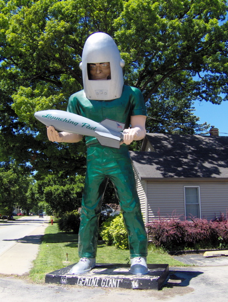
I drove through Wilmington, which I knew from last night. I passed the Launching Pad Drive-In and the Gemini Giant in daylight, and took a much better picture than yesterday’s:
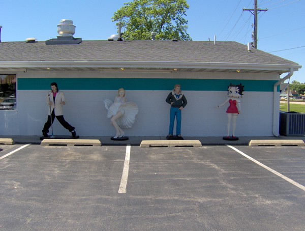
Further up the road is the since-1956 Polk-A-Dot Drive-In, where I spotted some celebrities:
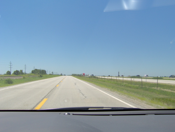
I noticed I was driving parallel to and in sight of the railroad tracks and the freeway for a good part. This reflects the evolution of the transportation lines: paved roads were built parallel to the rail tracks, and the freeway was built parallel to the older generation road. In this picture, I am on Route 66, the rail tracks are to my left, and interstate highway 55 is to my right:
At Odell, I came across a preserved gas station dating back to 1932. It is no longer operational. This is how they filled gas back then:
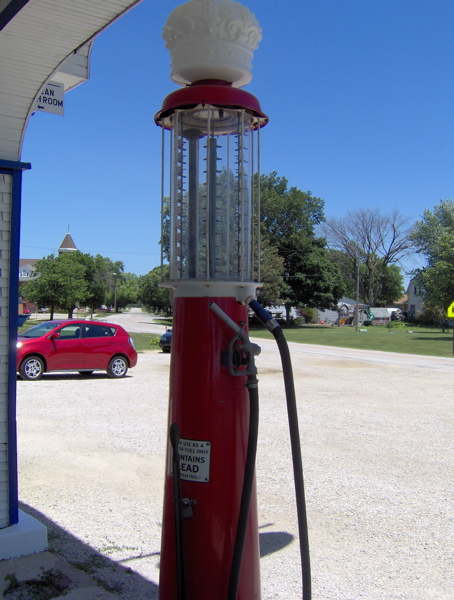
The transparent container on top has gallon markings. Fuel was measured out in it, then transferred to the car. I spoke to the storekeeper about last night’s thunderstorm, and he said he too was impressed by the light show. He said he hadn’t seen lightning like that in years, and he’s a local.

I followed Route 66 until Bloomington. The original pavement seemed to be running alongside me, cordoned off to motor vehicles. Here it is, the Mother Road itself:
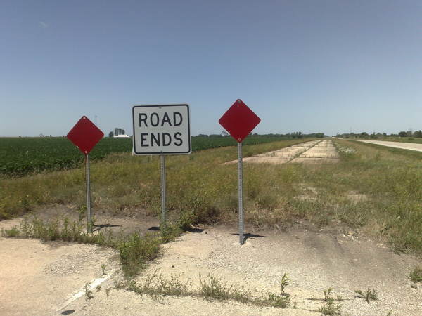
In Lexington, there’s a section of the original pavement like the one above that you can stroll on.

Starting at Bloomington, Route 66 starts overlapping with the freeway quite a bit, and staying on it feels like a lot of effort. I got on the freeway and headed for the Cozy Dog Drive-In at Springfield, started by the inventor of the corn dog. I thought I could smell those hot dogs from 50 miles away, but when I got there, I discovered they are closed on Sundays. Oh well. Back on the freeway and back off at Divernon to drive on 66, with the intention of eating at the Ariston Cafe, perhaps the oldest restaurant on Route 66. Route 66 was closed south of Divernon, but I got to Litchfield and the Ariston Cafe via the freeway.

It was late afternoon, and I’d had my fill of navigating Route 66 for the (sunny) day. I made a beeline for St. Louis (the next big city on Route 66), leaving the flat prairie of Illinois behind and crossing the Mississippi River. I didn’t know if I would stop at St. Louis or press on after a quick look at the Gateway Arch. But when I did get to the Arch, I was so impressed by its engineering and significance that I checked into a nearby hotel for the night and spent the rest of the evening touring the Arch.

The Gateway Arch is a staggering 630 feet tall. It is a graceful and majestic structure, conceived by the mind of a great architect and designed and forged by skilled engineers and workers. It is in the shape of a (weighted) catenary; the narrowing of the cross-section towards the top and the angled sides lend it great beauty.
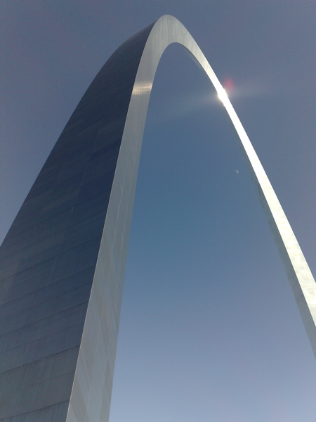
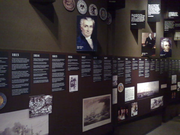
The Arch is a monument to the western expansion of the United States, and to the role that St. Louis played in that expansion. Given the history of Route 66 and the spirit of my journey, the Arch seemed to be an important and relevant symbol, and its symbolism, beauty and craftsmanship drew me to it. Everything about its exterior seemed to suggest that there was no access to its interior, far less its apex. However, I noticed a row of windows at the apex, and then a whole subterranean complex housing a museum and serving as a launchpad for a ride to the top of the arch from within. The museum is about the westward expansion of the US, and has a judicious selection of material that anyone could absorb in a typical visit:
The ride to the top was intriguing. Because of the curve of the Arch, regular elevators won’t do, and special trams have been installed to carry 40 passengers at a time to the top. The tram ride is claustrophobic, but very curious in its movement. It does not move like a train or elevator, but seems to move in all kinds of directions during its journey. The design should be interesting to understand. Here’s all one might want to know about the Arch:
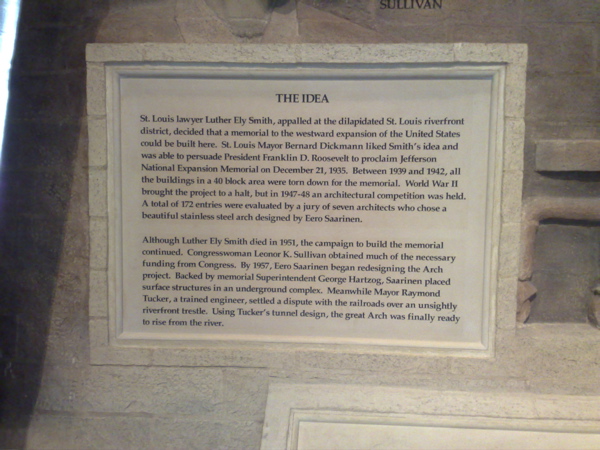
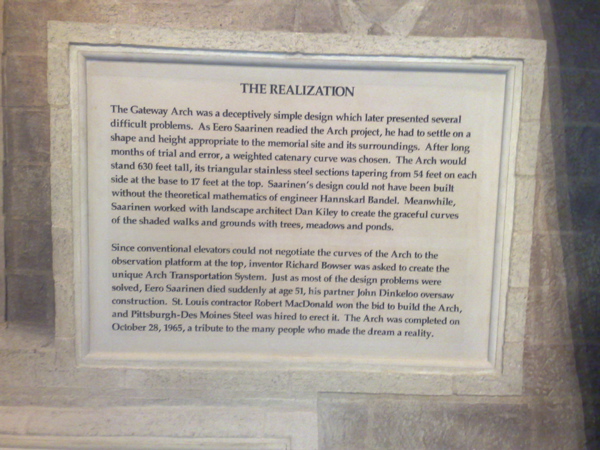
The Great American West and its colonization fascinate me, so this was a very satisfying discovery, over a few very fulfilling hours. I greatly enjoyed the displays at the museum of westward expansion, and I bought a reprint of a vintage book at the store: The Homestead Builder, Practical Hints for Handy Men, originally published for those migrating to the uncolonized West to homestead. So I rest in St. Louis tonight, before starting my westward journey tomorrow.
Day 1 on Route 66: Chicago, Joliet and Wilmington


View Larger Map

Route 66 was one of the first continuous spans of paved road running across a vast length of the US. It ran between Chicago and Los Angeles (specifically, Santa Monica). It officially came into existence in 1926, a time when the rise of automobiles was placing new demands on the transportation infrastructure of the US. With the establishment of Route 66, it became possible to drive from the shore of Lake Michigan to the shore of the Pacific Ocean without stopping or worrying about navigation. It wasn’t until 1937, however, that the last section of Route 66 was finally paved. The promoters of Route 66 used a number of schemes to popularize it, including organizing a foot race from Los Angeles to New York via Chicago. They dubbed Route 66 the Main Street of America, and indeed it ran through the centers of many small towns that thrived on the new business brought in by travelers. In the 1930s, America was in the grip of the Great Depression. To add to the misery caused by it, great famines and dust storms ravaged the livelihood of farmers in Oklahoma and nearby states. Many were uprooted from their homes and forced to migrate west on Route 66, drawn by news of plentiful employment in the orange orchards of California (news that was sadly overblown). John Steinbeck wrote his Pulitzer Prize-winning novel The Grapes of Wrath as the saga of one such group of (fictional) migrants. This book, and the John Ford-directed, Darryl F. Zanuck-produced movie version of it that soon followed, forever established Route 66 as a symbol of the pain, hope and adventure inherent in the American character. During the war years in the 1940s, Route 66 was filled with servicemen traveling between home and their stations, and trucks carrying the men and materiel of battle. In the 1930s and 1940s, Americans fully exploited this new corridor with their new means of travel. In the post-war years, it acquired its current fame, as Americans took enjoyable road trips on it to attractions such as the Painted Desert, the Grand Canyon and Disneyland.

Starting 1956, when the Federal Administration under Dwight Eisenhower laid out plans for a 42,500-mile system of roads that we now know as the interstate highway system, the demise of the official Route 66 began. Under the federal plan, narrow surface long-distance roads such as Route 66 were to give way to a modern high-speed, limited-access freeway system. Over the next 30 years, spans of Route 66 were progressively replaced by a sequence of five interstate highways: the 55, 44, 40, 15 and 10 highways. The old Route 66 lay mostly parallel to these new highways, but now eclipsed by these new high-speed, high-volume corridors. Route 66 does not officially exist any longer. However, most of the pavement still exists, and the families, homes, schools and churches that enjoyed the Route 66 spotlight also very much still exist, but outside the glare of the freeway. Thanks to the efforts of preservationists, the path of old Route 66 has been documented, and in many places signs installed to indicate that path. Today, the faithful still journey Route 66 in search of the vintage flavor of road travel.

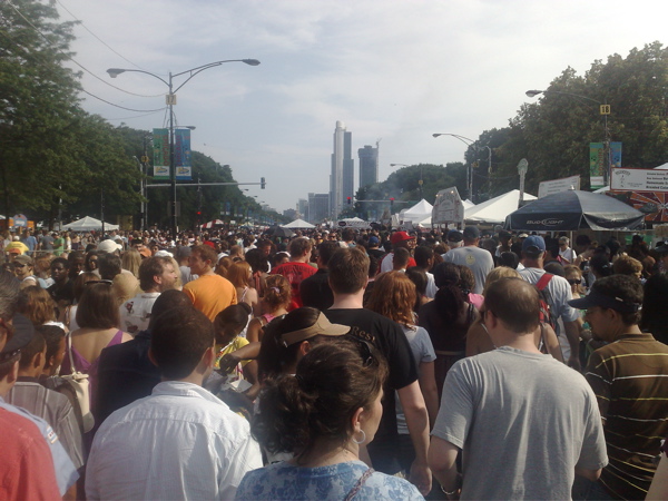
My first day on this short Route 66 trip was full of challenges. My flight from San Jose to Chicago was oversold, and there were tense moments at the airport while I waited to find out if I would be on the flight. I finally made it, but in a middle seat. I can’t remember the last time I wasn’t in an aisle seat on a flight. At Chicago, I had to spend almost an hour dealing with two separate issues with my car rental. Once those were resolved, I headed off to Grant Park, with the intention of starting my journey at the traditional beginning of Route 66 between Grant Park and Lake Michigan, at the intersection of Jackson and Lake Shore, and also pass by the symbolic beginning of Route 66, at the intersection of W. Adams and Michigan. However, when I arrived at Grant Park, the place was swarming with humanity, cars were being herded into reluctant paths by the orange vests, and roadblocks rendered GPS almost useless. I had stumbled right into Taste of Chicago, a massive food festival that has entirely taken over the Grant Park area this week.

The true beginning of Route 66 was hard to get to by car (and impossible to start the drive on, because of the closure of Jackson between Lake Shore and Michigan), so I walked to it and took a picture. It was a slow, slow crawl through the sticky ooze of summer people:

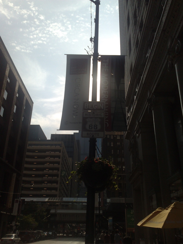
I spent what felt like ages just making it out of that mass of bodies. After a lot more time wasted on foot and in the car, navigating the obstacle course of road closures and restricted movement, I finally was able to start my Route 66 journey at its symbolic beginning:

A few minutes into my drive, I got to Lou Mitchell’s Restaurant, an establishment dating back to 1923 where it is customary for Route 66 travelers to have the first meal of their journey. Unfortunately they close at 3 pm, and I was well into my day.

I was quite grounded about the unpredictable realities of travel by now, and scaled down my ambitions for the trip. I realized I would spend an inordinate amount of time just staying on track without a navigator, so I rebalanced my freeway-Route 66 distribution to spend smaller amounts of time on Route 66 than I had initially planned. Accordingly, I took the interstate to Wilmington, a small town that Route 66 passes through, thinking I might stay there for the night. Wilmington turned out to be so small that there is no place to stay, except a very questionable motel. By the time I had decided to look for lodging elsewhere, it was dark and had started to rain. The lightning displays I witnessed on the way back north to Joliet (a larger town) were phenomenal. I had never seen such lightning discharges before. It was a hot and humid rain. On my way to Joliet, I came across the historic Launching Pad Drive-In and checked out their Gemini Giant, one of the kitschy “muffler men” that used to dot the roadside in past decades (terrible picture, I know):

I checked into a chain hotel at Joliet, with the usual amenities. I drove a substantial number of Route 66 miles between Wilmington and Joliet. In my first day’s experience, I became very aware how much I need the comforting familiarity of the interstate and its homogenized business establishments. The interstate feels like a cocoon. The purpose of this trip is to break through that cocoon as much I safely can. I felt out of my element on my first detour from the interstate, and will pursue that experience again on the remainder of this trip. However, after my short inspection of the motel in Wilmington, I have decided to retreat to a nice hotel in a large town every night. Also, I’m pretty sure my remaining posts are going to be much shorter than this! Time to enjoy the Ramada.

Will get my kicks on Route 66 starting tomorrow

My smallish, quickish Route 66 adventure starts on Jun 27 2009. I’ll be driving from Chicago, IL to Flagstaff, AZ over the course of nine days. I’ll do long hauls everyday on the interstate highways, but most of each day will be spent kicking back on Route 66. I will post updates and pictures here as often as I can go online, but at least daily, I hope. From Flagstaff, I also hope to check out Monument Valley. More on Route 66 and Monument Valley in my next post.