Slow connections and early morning hike means I can’t post about today. But it was a fun day.
Burgess Shale visit: kickoff
One of the most significant fossil discoveries of all time was made in 1909 in the Canadian Rockies, and named the Burgess Shale. The Burgess Shale fossils are a stunning representation of the Cambrian Explosion — the sudden and rapid emergence of modern multicellular organisms around half a billion years ago. The Burgess Shale has yielded a remarkable variety of remarkably well-preserved fossils from just after the Cambrian Explosion, fossils which have preserved the structure of even the soft parts of these early water creatures.
I have traveled to Canada to visit the Burgess Shale on a guided science hike led by the Burgess Shale Geoscience Foundation. Stop one is Calgary in the province of Alberta, where I am tonight. Tomorrow, I will travel to the small town of Field, British Columbia, which will be the starting point of the Burgess Shale hike the day after. I plan to take the scenic route to Field — a very, very scenic route. I plan to explore the Banff National Park area tomorrow, driving on the Icefields Parkway, reputed to be one of the most scenic drives in the world. I will stop at Columbia Icefield, which is one of the largest areas of snow and ice south of the Arctic Circle (I’ll bet Antarctica is not included in this comparison), and check out the Athabasca Glacier. I hope to post updates the next two nights.
Resources for first-time Route 66 travelers
Here’s what I recommend for understanding, finding and experiencing Route 66 if you are a first-time traveler.
First, get the historical and emotional perspective on Route 66 with this excellent book: Route 66: The Mother Road 75th Anniversary Edition. Soak in the history of the road and the people and establishments associated with it.
As a first requirement for navigation, you need an overview map for each day’s driving, with a bird’s eye-view of a large stretch of the route, names of towns at a glance, and interesting stops highlighted. For this, use this set of eight maps (one for each Route 66 state): Here It Is! The Route 66 Map Series. These are large, hand-drawn, very high-level maps that show the route on a gross level. You can clearly see that the route runs mostly parallel to the (five) interstates that replaced it. Visually, the only aid these maps provide for staying on the route are indications of which side of the interstate the route is on at any given place. But the text alongside each map gives turn-by-turn directions. You will have a very, very hard time getting by on those directions alone. Do not use these maps for turn-by-turn directions.
For turn-by-turn directions, use the very excellent book EZ66 GUIDE For Travelers – 2nd Edition. This is a spiral-bound book of detail maps for the entire route. This is the book you need to stay on Route 66. This book and the set of maps I mentioned above are complementary. Refer to the set of maps to track your overall progress and foresee what the next few hours have in store for you. Use the detail maps to navigate and get exhaustive information on what to do and see every few miles. Don’t consider doing your trip with just one of these resources; you need both.
Finally, get this nice picture book of things to do, see, learn about and experience on the route: Route 66 Adventure Handbook: Expanded Third Edition. Flip through this book before your trip and at the start of every day, and keep it handy as you drive. Stop when something catches your fancy!
With these books and maps, you have a wealth of information on where to stop and what to do. This amount of information is overwhelming if your goal is to distil the few mandatory attractions that you would feel ashamed to inadvertently miss. You might want to consider investing in something like AAA Route 66: The Best of the Mother Road, a fold-out map of Route 66 attractions considered by some to be must-dos. This map condenses the route to a bunch of “ooh-aah” pit-stops accessible from the freeway, but it’s still useful as a small, manageable list of highlights you probably won’t want to miss along your journey.
Keep a GPS stashed away in your glove compartment ready for emergencies; there is no need to have it powered on and available for reference all the time. Get lost a few times and find your way back using your maps, books and luck! Or decide not to find your way back right away! It’s part of the experience of following this grizzled old road.
Route 66 epilogue
My short, rather hasty Route 66 trip (Day 1, Day 2, Day 3, Day 4, Day 5, Day 6, Day 7) was the first time I traveled. Before this, I had only visited. On Route 66 I traveled over a huge distance, passed from the hot and humid East to the hot and arid West, crossed the Continental Divide that represents a boundary between pieces of the Earth’s crust, saw plains turn into mountains, mountains into desert, saw races and languages shift, but most fascinatingly, got a vivid flavor of what road travel used to be in its previous generation.
I realized that in the era of automobile travel I was given a taste of, individuality thrived along the highway. One independent gas station, one independent restaurant, one quirky local logo could become well-recognized and well-liked throughout the more than 2,000 miles of highway. I saw Lucille Hamons’ gas station, where she provided such caring attention to her customers for 50 years that she came to be known as the Mother of the Mother Road. I saw the Ariston Cafe, famous not through media advertising, but by word of mouth. I saw the Meramec Caverns, the Jack Rabbit Trading Post, the erstwhile Club Cafe, local businesses whose signs and logos got plastered all over the highway until they became symbols of an adventurous Route 66 trip itself. The most storied Route 66 symbols were not Meteor Crater or the Petrified Forest or Grand Canyon. They were individuals, their diverse establishments along the route, and their frequently eccentric creations.
Road trips are poorer for having lost such kaleidoscopic companionship along the journey. Today, who has a fond attachment to a particular location of a chain restaurant along the freeway, or the person providing service there? This loss was so vividly clear to me when I had a drive-through meal at a chain restaurant on this trip. I am not fanatical enough to claim that the interstate highway system is an evil that should never have come into existence. But I do see the compromise travelers have had to make with the replacement of the neighborly 2,000-mile Main Street that used to be arrayed on both sides with an unrestricted variety of creative money-makers.
I have a vague feeling I have been exposed to a lesson for developing nations. However, being convinced of the necessity both of efficiency and of individuality, I am unsure what the lesson is. What I am certain of is I now have a dread of the replacement of personalities with corporate logos.
Once I saw how personal Route 66 was to the people who worked it and traveled it, I acquired a fondness for finding and staying on the old road. Taking the necessary freeway shortcuts to make time seemed like a betrayal. But there’s more that adds pleasure to sticking with Route 66—it’s often a hard road to find, and rewards you with a sense of satisfaction when you do manage to join the dots between successive pages of your map book and manage not to veer from it. In fact, an obsessive person could easily become consumed by the urge to follow every alignment of Route 66. I can see particular personality traits that probably run through devout Route 66-ers, and can understand why someone might devote his life to documenting every scrap of this road.
I didn’t suspect in advance that Route 66 would grow on me this much during the seven days I followed it. When I halted at Flagstaff, I felt regret at not being able to extend the journey all the way to the end of Route 66, to Los Angeles and Santa Monica. Maybe it’s for the better I couldn’t, since it is now certain that I will return to Route 66, starting with the parts in California, where I live. When I do return to the road, I hope not to take any shortcuts anymore.
I wonder, when I do return, how many of those neon signs will still be there? When I was passing through Albuquerque, I saw a motel being bulldozed. Was it a Route 66 era motel? I don’t know. Eventually these withering leaves will completely fall off and disappear. But while they exist, they will be a treat for lovers of Americana like myself. American popular culture and signs from the middle of the century fascinate me, as they do many others, so Route 66 was a treasure trove to me.
But as I relived this slice of American history, a new desire grew inside me. I started wanting to explore India the way I have been exploring this country, to taste history that is more personal, that surrounded my own ancestors. Being at such a distance from India for so long has had the positive effect of getting me interested in the country from the perspective of an outsider. Combining this perspective with all the knowledge I have about India as an insider, I will truly be able to understand the land now. I look forward to making those journeys.
Driving Route 66 has changed the way I experience the pavement through my car. I am now aware of how well the grade of the road follows the land, what discontinuities exist in the pavement, what the vintage of the road might be. Before this trip, I used to be oblivious to frontage roads running parallel to the freeway, and never recognized the significance of the brown “Historic Route 66” signs I noticed in so many places in California. I paid no particular attention to neon signs, never tried to divine what era they might be from, or why they became defunct. I will look at all these things differently now. I used to take for granted the freeway as the default means of long-distance driving, never reflecting on what it might have evolved from. I now see a fuller picture of how things have been in the past, thanks to driving on this old road and noticing how it ran along the older railroad, noticing how it often intersected with old cattle and people trails running over plains and through mountain passes. I no longer think of Route 66 as yet another road trip from one place to another. This trip has closed a loop in my life between today and about 15 years ago, when I checked out John Steinbeck’s The Grapes of Wrath from the school library and relished every page. It didn’t stick in my consciousness that the road I had read about in that book was the same Route 66 I would start hearing about when I moved to the US many years later. But the dusty, epic nature of the journey in that book did remain in my memory. Driving many of those same miles delivered me closer to that time in my youth.
Days 8 and 9 (not) on Route 66: Monument Valley, Meteor Crater and Sunset Crater
I ended my Route 66 journey at Flagstaff. I very much intend to return to Route 66. Living in California makes it convenient for me to explore the part of it I missed on this trip (Flagstaff to Santa Monica). I’m looking forward to crossing the Mojave Desert and exploring the Los Angeles alignments, something I never did in all my years in L.A.
As planned, I spent July 4th touring Monument Valley. This concentration of tall sandstone mesas and buttes has provided defining images of the Great American West in many movies and photographs over the years. It is a few hours away from Flagstaff and Route 66, so it was never a Route 66 attraction.
Monument Valley is in Utah and in Navajo Nation, a semi-autonomous Native American territory. The Navajos manage Monument Valley. The two good ways to see Monument Valley are from the top of a lookout hill (which houses a very new hotel), and from the ground, driving the 17-mile track through the valley floor, an extremely rough ride. I liked the first view better. On the drive, however, I came to a high point with a panoramic view of the valley, which I was able to capture by stitching together a number of photographs:

This landscape has been used in many John Ford westerns, as well as newer movies like Windtalkers. (Incidentally, this movie is about the Navajo code talkers of WWII. The Allied forces were looking for a good code for their secret transmissions, and hit upon the idea of using Navajo Indians to make these transmissions in their native tongue, which was understood by only a handful of people outside the tribe.) As I drove through it, I imagined the time when white settlers and Native Americans were warring over this land.
Here is a picture from the lookout hill. (My camera is not capable of taking good landscape pictures in bright sun, so I enhanced this picture and the one above.)
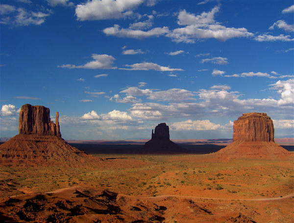
I spent the day in Monument Valley and left before sunset. Sunset would have been a good time to view Monument Valley, but I was too tired after driving in the sun for hours on that cratered road. I stayed the night at Kayenta, Arizona, a small town nearby. Kayenta is officially on the Indian reservation, and I couldn’t get any beer at dinner, because alcohol is not allowed on the reservation. This was my first time in an Indian reservation. I wasn’t fully aware of the semi-autonomous operation of Indian land, and am curious about how the state, federal and native American authorities share control and jurisdiction in this enclave.
I had planned to go out at night in the Monument Valley area to do some stargazing, and was greatly looking forward to it. However, I couldn’t, because it rained heavily that night. I overheard at dinner that the people who stayed at Monument Valley till sunset got a double treat: sunset views as well as panoramic views of dramatic lightning from the storm clouds.
July 5th was my last day of this trip. I had no plans for this day, and decided to backtrack on my path to go back and check out Meteor Crater east of Flagstaff, something that I had hoped to see while driving Route 66. It’s a short distance from Flagstaff, and worth the drive. Here’s a picture of it (also enhanced):
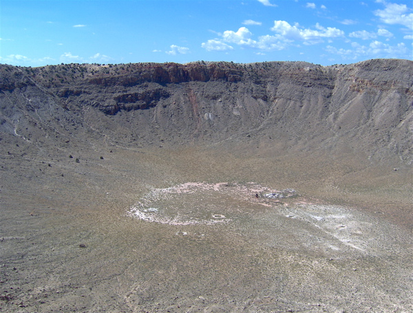
This is the impact crater from a meteor that collided with the earth about 50,000 years ago. The meteor lost only a negligible amount of its mass and velocity in traveling through the 100 miles of the earth’s atmosphere. The crater sits in a large flat area of complete emptiness clearly visible for miles in all direction from the high observation deck on its rim.
On my way back to Flagstaff airport for my flight to San Jose, I made a stop at another crater, of a very different kind. Sunset Crater was formed about 900 years ago from a volcanic explosion. The lava flows from that eruption destroyed all life for miles around, and the area is slowly re-vegetating. The crater used to be open to hikers till the 1970s, but is now closed to give plants a chance to grow on its slopes. This picture shows the hill of the volcano, with the remnants of the lava flows in the foreground, by the side of the walking path.
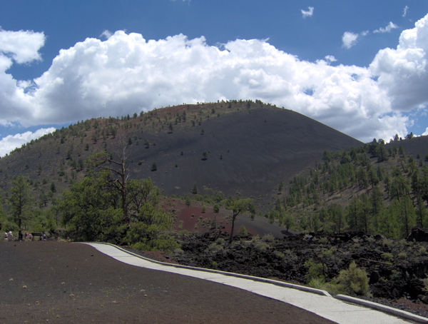
Both Meteor Crater and Sunset Crater used to be side-trips for Route 66 travelers.
I finally gave up my rental car at Flagstaff airport after eight days, 2464.4 miles of driving, one nasty scratch I put on it while backing up, and one speeding ticket that I finally got on my last day. To round things out, on the way back to San Jose, my bag didn’t make the connection that I made at Los Angeles, and it arrived home one day after I did.
It was a great trip, very absorbing and immersive. This trip really has done what travel is reputed to do—broaden the mind. I hope to write my Route 66 retrospective the first chance I get.
Day 7 on Route 66: My journey ends at Flagstaff
I entered Arizona today, and ended my Route 66 journey at Flagstaff. Route 66 goes on, of course, all the way to Santa Monica.
I started my morning by resuming my poking around in Albuquerque. The old Route 66 still forms the main drag through town, Central Avenue. At 18 miles, Central is the country’s longest main street. I headed west on Central from my hotel, approaching downtown, and soon hit a row of vintage motel neon signs that I spent quite some time chasing down and photographing. I ran into a couple from Canada who were making the same stops as me to take pictures of the same signs. They had been driving from Chicago over the last week as well. We discovered we’d made some common stops, and talked about the crowd and street closures at the Chicago end. Here’s some of the classic motel neon that was so fascinating to both me and them:
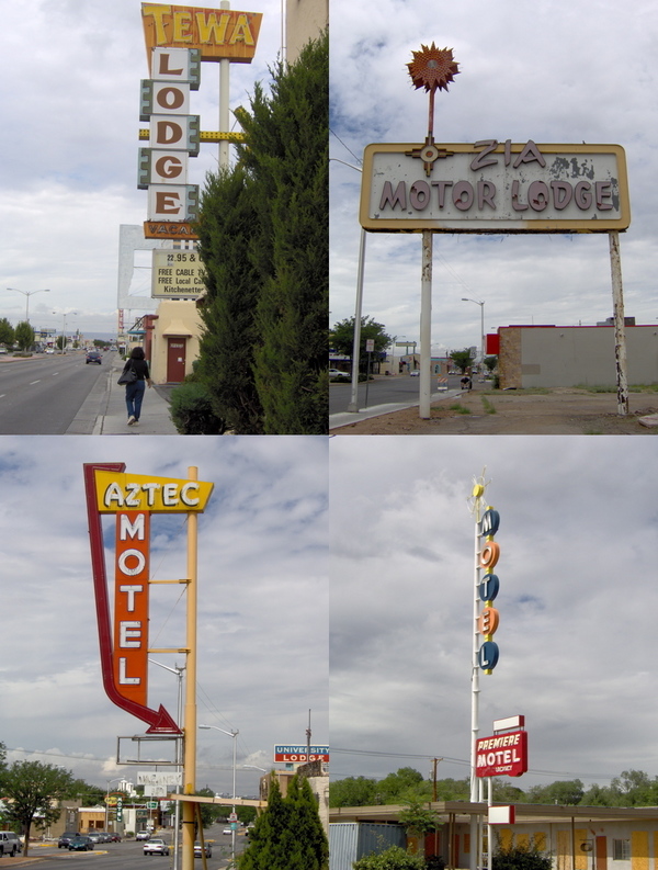
The names of motels in Albuquerque had a strong Central American flavor. I don’t think I saw this in any other town, even in New Mexico. But all of New Mexico does have a Native American flavor. The state is dotted with “trading posts” where Native American artifacts are sold. These probably started life as real trading posts facilitating commerce between two communities with different currencies (the dollar versus whatever was of use to the Indians). Opposite the KiMo theater in downtown Albuquerque is a wholesaler of Indian handicrafts called Skip Maisel’s. This store has a monstrously large collection, which one can spend hours browsing through:
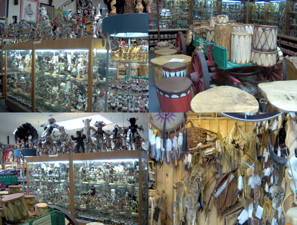
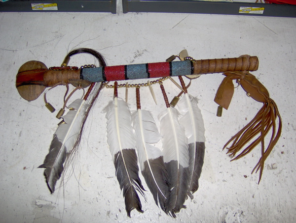
I was very interested in the drums and bows-and-arrows, but I didn’t buy either. As my flagship souvenir of the trip, I bought a traditionally bedecked Navajo battle club, with a flat stone head and a wooden handle decorated with feathers and horse hair:
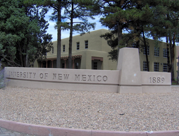
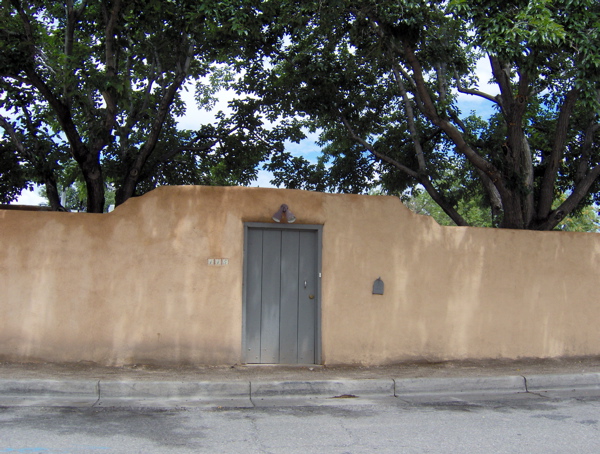
The pueblo style of architecture, mirroring the style of construction used by ancient Indians here, is used liberally in Albuquerque, both by old and new constructions. Here are the Journalism Building at the University of New Mexico, and a nondescript residential building in a side street:
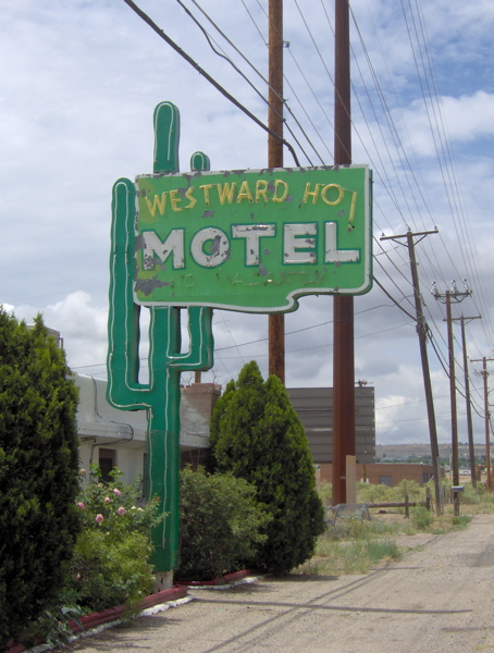
On my way out of the city, I crossed the Rio Grande river, which was not as impressive as it sounds. There were a few more vintage motel signs on this side of downtown, the most evocative of which was for the Westward Ho! motel, with its exotic saguaro cactus and enthusiastic name capturing the spirit of exploration that got people driving for pleasure on Route 66:
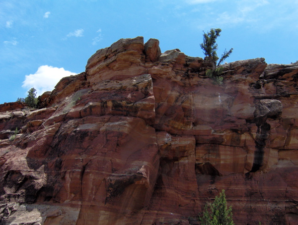
After leaving the city, I followed Route 66 through the towns of Mesita, Laguna, New Laguna, Paraje, Cubero and San Fidel. Also, in the midst of these was the highly incongruously named Budvile. The road snaked through quiet places where you could pull over by the side of the road, listen to the birds and insects, and admire the rocks of New Mexico:
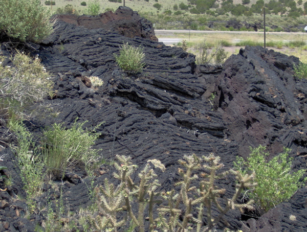
The next two towns were McCartys and Grants. Between these two, the road was lined with black lava beds. Apparently, there were eruptions in this area up until a few hundred years ago.
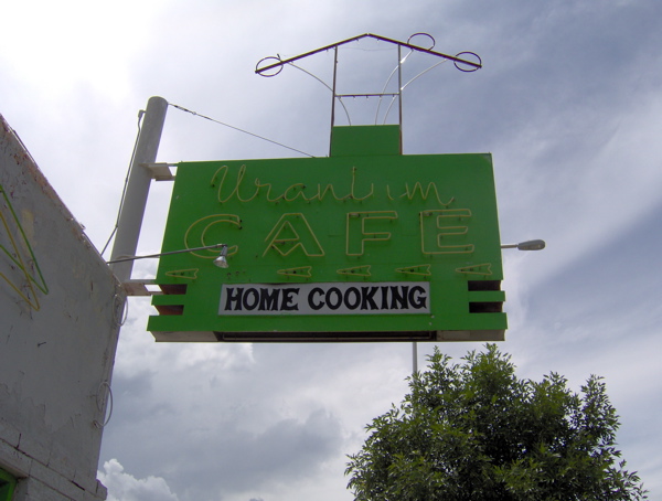
At Grants I came across some interesting motel neon, as well as neon for this interestingly named cafe (named so because Grants was the site of uranium mining after the element was discovered there in the 50s.)
At this time it was quite late in the afternoon, and I needed to reach Flagstaff, Arizona by nightfall, as my Route 66 trip was drawing to a close. I took the freeway to Gallup, with the intention of following Route 66 from Gallup into Arizona. This was a wonderful drive. A long Santa Fe Railroads train pulled its mile-long load of shipping containers alongside the freeway while the sun and rainclouds quilted the sky above. Lightning arced between low, dark clouds and the ground in the distance while I drove under sunny sky, revealing just how much of the entire horizon one can see in such open country.
At some point, I crossed the Continental Divide, the separator for the direction of flow of rainwater in the continent. When I got to Gallup and prepared to rejoin Route 66 into Arizona, I noticed that Route 66 in Arizona overlaps with the freeway almost entirely until Flagstaff. So I stuck with the freeway, entering Arizona. Very soon, the rock formations became more striking and varied in shape and color.
My first stop in Arizona was Petrified Forest National Park. The old Route 66 used to run right through this park, and there is now a memorial to that path in the park. The petrified trees of this park were a celebrated attraction for Route 66 travelers. These fossils are indeed amazing; whole trees turned into solid rock by the deposition of minerals within them.
After I exited this park, it was too late to see Meteor Crater, and I decided to make only a couple more quick stops before speeding to Flagstaff. At this point, I had navigated the esoteric twists and turns of Route 66 with sundry maps and guidebooks in hand for almost a week. I had experienced tangibly what Route 66 travel meant, and how it differs from travel today. I had acquired some skill in following the tangled web of alignments that are collectively called Route 66. I felt a sense of parting at leaving behind Route 66. For my final Route 66 stops, at Holbrook and Joseph City, I needed one last reference to set me on my path, and this came in the form of one of the familiar brown “Historic Route 66” signs I had been following through seven states. These signs are infrequently placed, but when they are, their presence is very reassuring to an unsure traveler. I decided to stop and take a picture of this last sign that I needed guidance from on this journey.
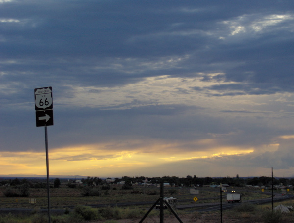
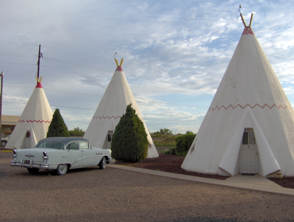
My last two stops were the Wigwam Motel and the Jackrabbit Trading Post, both of them Route 66 classics that are now part of Route 66 lore. The Wigwam Motel used to house its guests in cabins shaped like teepees. Today it has been preserved complete with classic cars of the 50s and 60s parked outside the cabins:
In this town, Holbrook, I also checked out the Rainbow Rock Shop, with dinosaur sculptures aplenty adorning its front. Route 66 used to be dotted with giant sculptures of various creatures, such as these dinosaurs (and many others like it), and the Gemini Giant and Blue Whale that I posted pictures of earlier. These giants used to be an entertaining part of the Route 66 flavor.
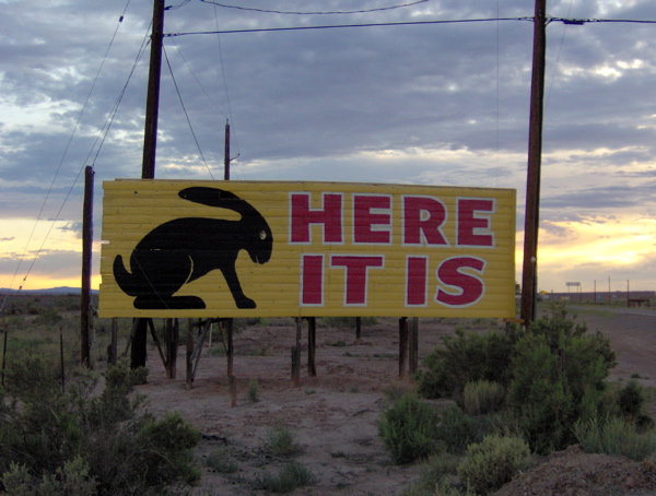
My final stop before Flagstaff was the Jackrabbit Trading Post. Its mascot, the jackrabbit (and its logo, “Here it is”) used to be emblazoned on billboards all over Route 66, and became an instantly recognizable icon among travelers. This reminds me of the Meramec Caverns barnside advertisements and the Fat Man logo that I spoke of earlier.
After this I headed off to Flagstaff, where I had a hotel room waiting for me, the first one I had reserved in advance, on account of this being the Fourth of July weekend. I reflected back on the beginning on my trip in crowded, humid Chicago, and my first, nervous, rainy night of hunting for a hotel room in Wilmington and Joliet. I have gathered a few observations and insights from this trip, which I will put down after I return from Monument Valley tomorrow night.
Day 6 on Route 66: Taking it easy in New Mexico
I didn’t think I would still be deep in the interior of New Mexico today, but I am. I took it easy today, spending a fair amount of time poking around in towns. New Mexico’s dominant flavors are the desert landscape, the Native American presence in design themes and local business, and, along Route 66, the sudden explosion in vintage neon signs and motels compared to the previous states on the route. In those states, Route 66 seemed predominantly a 30s and 40s road; in New Mexico, it has a decidedly 50s and 60s feel. I didn’t find any vintage pavement on any of the alignments I drove on in New Mexico. I didn’t find the road snaking through well-shaded farming communities.
I spent my morning poking around in Tucumcari. In this morning picture of the Blue Swallow Motel (my place of lodging last night), notice the garages next to the rooms; these were a characteristic of “motor courts” in the era of the Blue Swallow:
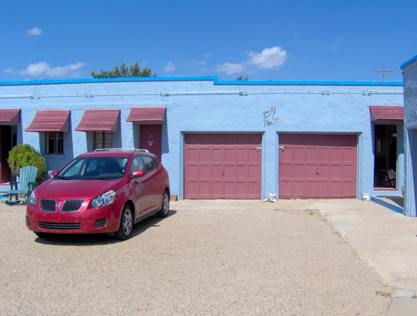
You should know that this motel is right on Route 66, meaning its driveway is on Route 66 itself. This differs, of course, from today’s model of placement of businesses alongside highways—the highway has well-defined entrances and exits, and businesses are not located by the side of the freeway, but on surface streets accessible from the freeway via exits. If you can picture the difference, you can picture one of the most important aspects of Route 66 history—everything was on the highway itself, no exits, no side streets to go into. You could cruise down Route 66 and pull into any motel at a moment’s notice. Route 66 was America’s Main Street. Here are some of the choices that would have greeted you as you drove in Tucumcari:
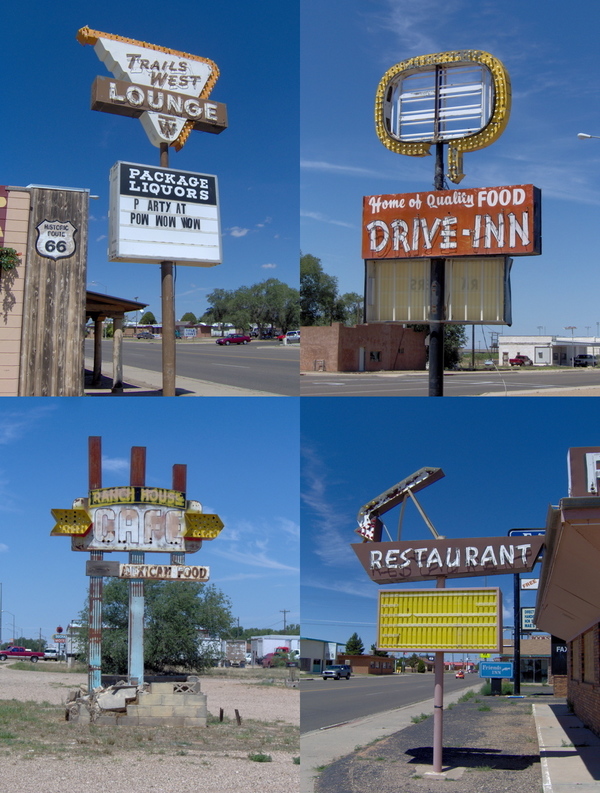
Curious shapes would attempt to attract your attention:
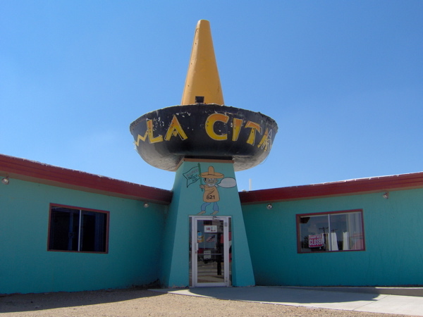
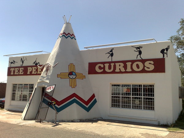
The second picture is of Teepee Curios, an old Route 66 stalwart that is still in business. Here I bought a mysterious sculpture of some exceedingly ugly deity. My theory is that it’s carved out of solidified dung. The store owner doesn’t know anything about them; they were part of a 30-year old cache of curios he bought off someone else. This store lives and breathes Route 66.
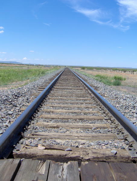
Finally, I headed out westward on Route 66 from Tucumcari. I passed through a set of non-towns—Palomas, Montoya, Newkirk, Cuervo—before reaching Santa Rosa. This land is flat, dry, rocky and unending as far as the eye can see. At one turn in the lonely road, I scattered a flock of five or six vultures that were feeding on some dead animal. Upon closer inspection, it turned out to be a deer. I found it symbolic that yesterday a live and very energetic deer had been scampering in my path in a woody stretch of the route, and today a dead one lay baking and rotting under the hot desert sun. I am driving into the desert.
A freight train with something like a hundred carriages drifted past me on the tracks that accompany the road:
At Santa Rosa, I ate at Joseph’s, which has adopted a famous Route 66 logo—a satisfied-looking “fat man”—that was left homeless after its famous owner, the Club Cafe, folded.
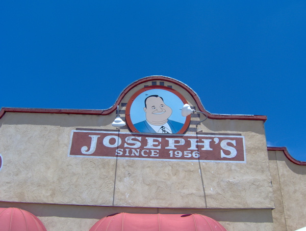
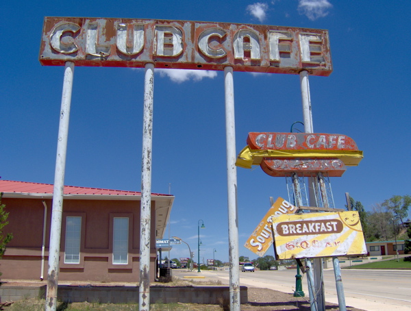
In Santa Rosa, I came across some more classic neon and vintage motel designs. As you can tell, design themes and Americana from the middle of the century really get me excited.

After lunch, I took Route 66 again to the big city of Albuquerque, New Mexico. I gained altitude, and mountains loomed all around me. I drove through a mountain pass. In centuries past, trails for people and cattle cut across the plains of the West and sought passage through the mountains. These trails are now the routes of roads and highways. I have been driving on and across some old, old cattle trails in my journeys on Route 66. The old trails used to have markers placed to help guide people along them. While driving through the mountain pass, I came across the site of such an ancient trail marker:
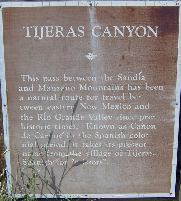
Near this sign I also found a non-trivial snake on the side of the road. Snakes, armadillos, jackrabbits and large lizards are the iconic species represented in the lore of Route 66 in this part of the country.
Soon I descended from the Sandia-Manzano mountain pass into the Rio Grande Valley and reached Albuquerque. I intended to spend some time here and then move on, but when I opened my guide book, I realized there was enough here to keep me busy for a while, so I checked into a motel for the night.
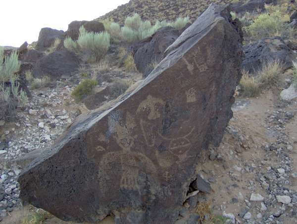
Outside of Albuquerque is the Petroglyph National Monument, the site of thousands of etchings on rock surfaces. Most of this rock art is believed to have been created by the ancestors of today’s Pueblo Indians between circa 1300 and circa 1680. Some others are believed to have been carved as early as 2000 B.C. I took the short drive and hike to see them. I saw but a handful out of the thousands scattered throughout the park:
Returning to Albuquerque, I checked out the center of town, with the old Route 66 running straight through it and businesses on either side. Unlike the many, many smaller Route 66 towns I saw that had become virtual ghost towns after the death of Route 66 choked off the traffic, bigger Route 66 towns that had other aspects to their economy sustained their Route 66 business centers. Albuquerque is one such city. I enjoyed the unique visual character of this city, strongly reflecting the unique cultural mix of Native American, Hispanic and Anglo here. I checked out the famous architecture of the KiMo Theatre, done in a style that combines themes from these three cultures. I surveyed some more vintage motels and their neon signs, before setting down for dinner at the 66 Diner. This is not a vintage establishment, but is specifically designed to capture everything about the distinctive 1950s diner aesthetics and experience. I loved the food, styling, decor and service:
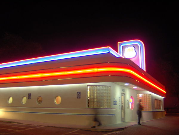
Tomorrow I must end my Route 66 journey in order to have time for Monument Valley before my flight back home on Sunday. Many interesting places lie between now and then: the Rio Grande, the Continental Divide, the Petrified Forest, Meteor Crater.
Day 5 on Route 66: Through the Texas Panhandle; Tucumcari Tonite!
Another exciting day on Route 66, with a huge load of things to write about. I drove in three states again today: Oklahoma, Texas and New Mexico. Texas, big though it is, has the second-shortest stretch of Route 66 among the eight states that the road passes through. Only Kansas has fewer miles. So I started my day in Clinton, Oklahoma, crossed Texas, and am staying for the night in the classic Route 66 town of Tucumcari, New Mexico.
The character of Route 66 shifted dramatically today. Today I really saw what a Route 66 ghost town looks like, and I saw it again and again in town after town. The rural towns and narrow, winding roads of the last four days have changed to towns that seemed to derive more of their business from Route 66 travelers, and straighter roads through completely empty flatlands. Demographics, climate, terrain, vegetation—big changes in all of them.
Breakfast in Clinton was interesting. I ate at a small restaurant attached to the motel where I’d spent the night. I overheard much chatter between a customer and the staff about local town folks—who was getting married to whom; who was whose uncle, aunt, son or daughter, and so on. A roofer talking about somebody’s son now serving in Iraq and his daughter looking for waitressing jobs.
After breakfast, I started my day with a visit to the Route 66 Museum in Clinton.
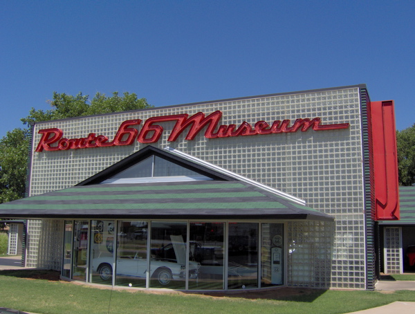
They have a good collection of material evoking the flavor of Route 66 over the decades, and lots of good information. My favorite exhibit was the late-1920s truck loaded up with supplies and baggage, just as it would have been during a real trip in those days. Notice the desert water bag, presumably for the radiator:
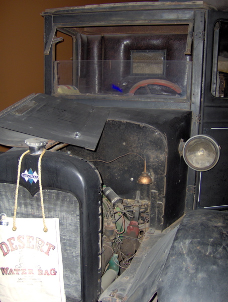
Remember that Route 66 crosses the Mojave Desert between Arizona and California, a stretch I will sadly not be doing on this trip.
After spending some time at the museum, I hit the road again, following Route 66 through the Oklahoma towns of Foss, Canute, Elk City, Sayre, Erick and Texola. I ran into a lot of trouble finding and staying with Route 66 in some of these parts. A word about navigating Route 66: this highway does not officially exist. In many places, it runs over complicated city streets. Numerous detailed maps have been published by enthusiasts to guide drivers, but it it still rather difficult to find all parts of this old route, especially without someone in the passenger seat to do the navigating.
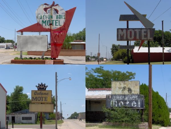
In Canute, Erick and Texola I saw real ghost towns—towns that withered away after the interstate took away their traffic and livelihood. Starting here, the ghost towns have a very decrepit feel to them; there is invariably a lot of rusting metal as well as disused neon. In the 1950s, bright neon signs became hugely popular, and the many motels that had sprouted along Route 66 used neon signs to attract guests. A nighttime driver down a Route 66 town in those days would have been dazzled by the light display inviting him to stay at the roadside motels. Today, many of these neon signs remain; unlit, unclaimed and degenerating in neglect, the advertised business no longer in existence. Here are some I saw in Canute and Erick:
Texola is the last Oklahoma town before Texas. I’m not sure if I can call it a town. It has city limits and some street signs, but apparently no people, only yards full of rusting metal and rotting wood. The interstate runs just a short distance away, yet completely diverted the life out of this town. I would not want to be alone outside my car in Texola; even the brief period of time I had my window rolled down to take this picture gave me shivers, because there was some strange industrial sound emanating from this lifeless building:
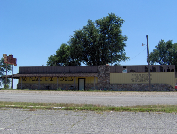
With this ended my stay in Oklahoma, and I entered Texas. Route 66 cuts east-west through the northern projection of Texas, the Texas Panhandle. This was perhaps the flattest, lowest terrain of my drive so far. There were some trees initially, and in this wooded part I had a near collision with a rather idiotic deer. In Texas, the density of towns thinned down, and the towns themselves looked strangely desolate and eery.
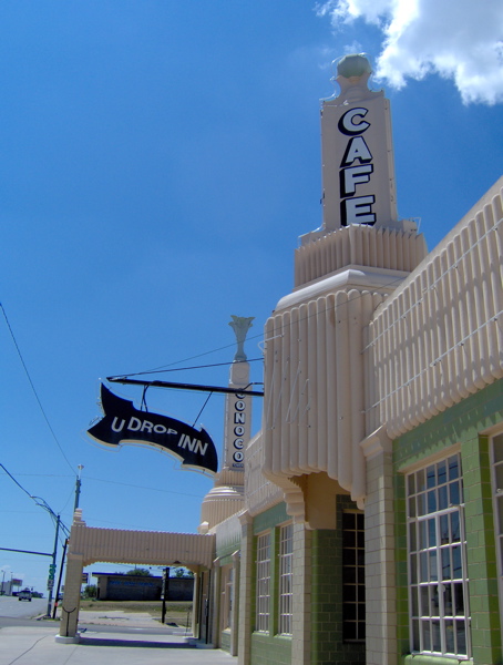
I passed through Shamrock and McLean before hitting the freeway till Amarillo. A classic piece of Route 66 architecture is Shamrock’s very Art Deco U Drop Inn, a gas station and cafe dating back to 1936. It has recently been restored. In the old days it used to blaze with enough neon to glow over large distances across the Texas plains, and the restoration apparently has faithfully recreated that. In an act of defiance, I did not drop in, but only took pictures of the outside:
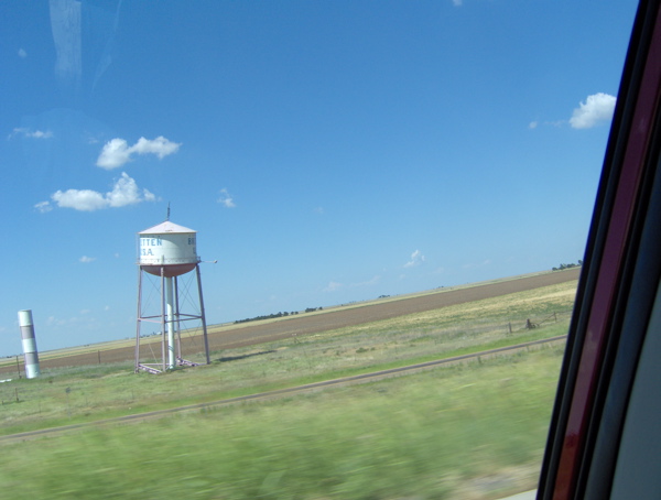
On the freeway drive to Amarillo, I took this drive-by picture of the famous leaning water tower in Groom, another Route 66 oddity-turned-roadside-attraction that drew travelers into town to spend their money:
In Amarillo, I ate at the Big Texan Steak Ranch restaurant, an institution among Route 66 travelers since 1960 (though now in a new location post-interstate invasion):
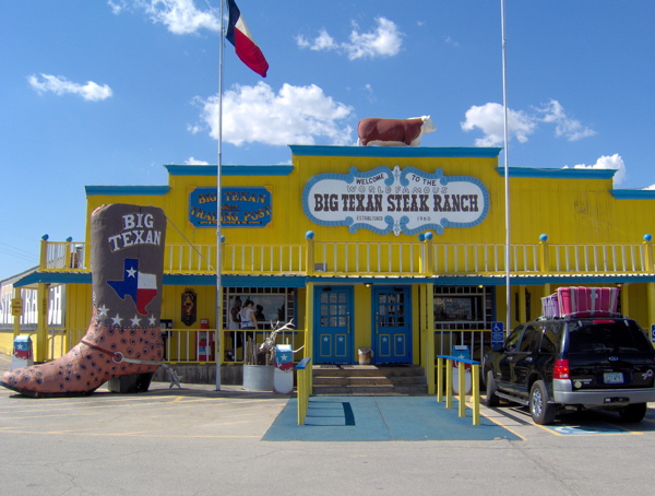
On the porch of the Big Texan Steak Ranch, I came across a flyer agitating for the use of English by Spanish-speaking Latinos, of which there are of course many in Texas. A reminder of the demographic variations I was driving through on this long trip.
Here’s the Big Texan gimmick: they will give away a free 72-ounce steak free to anyone, provided he or she can eat the whole damn slab of beef in one hour, along with sides of baked potato, shrimp cocktail, salad and buttered roll. (If the attempt fails, the customer pays.) In their own words, “Many have tried. Many have failed.” Well guess what—as soon as I settled into my seat, a challenger started working on his meal, and successfully ate everything in about 58 minutes, about as long as it took me to finish my sandwich and fries. I had timed my visit perfectly.
Outside of Amarillo is another legendary roadside attraction (popular with the Route 66 crowd now, but not originally linked to Route 66 itself): the Cadillac Ranch. I’ve been seeing pictures of it for years, and my curiosity has been slowly whetted over the years, so it was a great thrill to finally visit the place. It is best described by pictures:
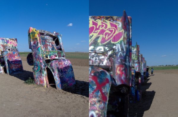
This is a public art installation from 1974, commissioned by an eccentric millionaire, which is what I will be in my middle age. People freely spray-paint graffiti on these half-buried Cadillac chassis.
After Amarillo, I successfully stayed on Route 66 for the rest of Texas, passing through Bushland, Vega, Adrian and Glenrio. Ghost towns, all of them, especially Glenrio, with its chorus of dogs barking at me as I stood outside a house to take a picture. Adrian has a cafe, the Midpoint Cafe, claiming to be at the midpoint of Route 66 (between Chicago and Santa Monica). In reality, the midpoint of Route 66 cannot be defined.
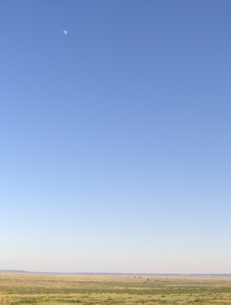
I left Texas and entered New Mexico, staying on Route 66 and headed for Tucumcari, where I intended to stay. The New Mexico terrain started displaying some distant highlands, unlike Texas. I will run into these mesas and buttes tomorrow, and in Monument Valley, but for today, the New Mexico landscape was just jaw-droppingly vast and open:
Imagine my disbelief when I came across a Punjabi dhaba at a gas station along Route 66 in the middle of this vast emptiness:
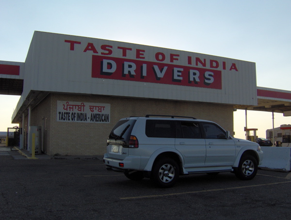
Outside of Los Angeles, this has to be the only Indian establishment along Route 66. I went inside and found quite a few Indian men wandering about, apart from the Punjabi proprietors. I tried to ask a couple of the customers where this hidden ore of Indianness was springing from. The first guy seemed suspicious of me and claimed he didn’t live locally (rubbish), and the second guy seemed uncomfortable with English and mumbled something in half-Punjabi, half-reluctance. I left this mystery unsolved.
Soon I reached Tucumcari. Tucumcari is classic Route 66. In the days of Route 66, a night’s stay at this town was customary among travelers. This tradition is still maintained by the revival travelers. Billboards along Route 66 used to be emblazoned with the slogan “Tucumcari Tonite!” to draw travelers into town for the night. Tucumcari has its share of abandoned businesses and non-functional neon signs, but unlike all the other small Route 66 towns I passed through today, Tucumcari still has managed to maintain a significant amount of the luster from the old days. Many of its neon signs still light up at night, failing motels have been revived under new owners, and many people do stay here for the night.
I was lucky enough to get the last remaining room at the historic and quite famous Blue Swallow Motel, a true Route 66 classic. It was built in 1939, and has recently been restored (but not ruined) by its new owners. They turned on their neon soon after I checked in. Classic stuff, and it feels great to be staying here.
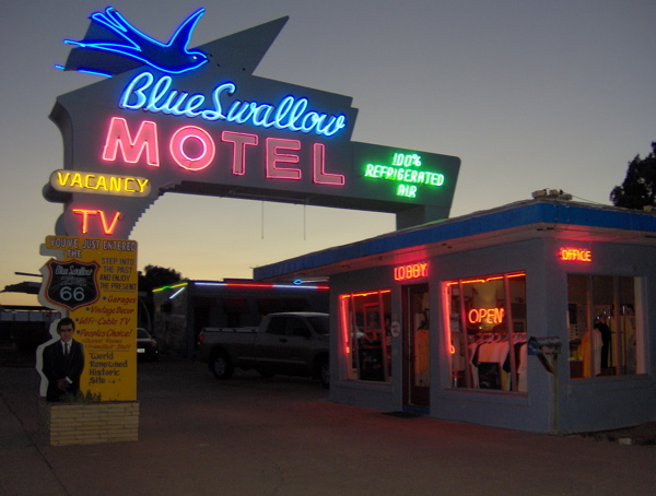
I felt much less tired today, possibly it’s so much less humid in Texas and New Mexico than it was in the previous four states. Tomorrow, I drive across New Mexico.
Day 4 on Route 66: Pushing through Oklahoma
This is going to be a long post! Today was a big day on my trip: I passed through Oklahoma, which is the most important Route 66 state in my opinion; I also drove through two other states, Kansas and Missouri, making it three—count ’em, three!—states I passed through today; I drove on possibly two of the best sections of Route 66 (details coming up!); and finally, I made up for time lost in the urban obstacle course of Chicago.
First, a note on alignments. I have been speaking of Route 66 as if it has been in the same place on the map since its origination. That this is not true should be clear from my earlier example from Illinois, where I showed the older, cordoned-off, pavement running alongside the Route 66 pavement I was actually driving on. That would have resulted from realigning the road along a different route, in this case, a route exactly parallel to the original. Many, many realignments have happened over the thousands of miles of Route 66 over its many decades of operation. In many cases, more than one alignment runs between two points, and the traveler needs to choose between them (unless he is one of those who devote their lives to documenting and experiencing every single inch of Route 66 alignment; the guide books I’m using are written by some of these people).
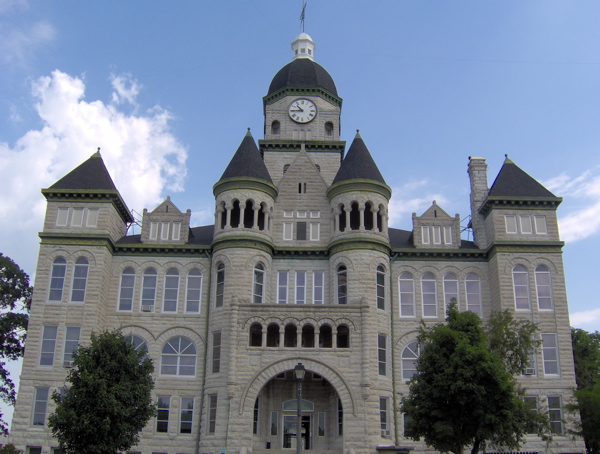
I had stayed for the night in Springfield, Missouri, which is towards the end of Missouri’s share of Route 66. I started earlier than usual, because my intention was to push through Oklahoma today. The morning was a very pleasant time to be driving on rural roads. I headed out on Route 66 from Springfield, passing by a number of quiet towns—Halltown, Heatonville, Albatross, Phelps, Rescue, Plew, Avilla, Carthage—before reaching the big town of Joplin. These small towns, with the exception of Carthage, have acquired a ghostly feel after a realignment many years ago. Carthage was home to rich people who made their money in mining. Here’s the stately courthouse:
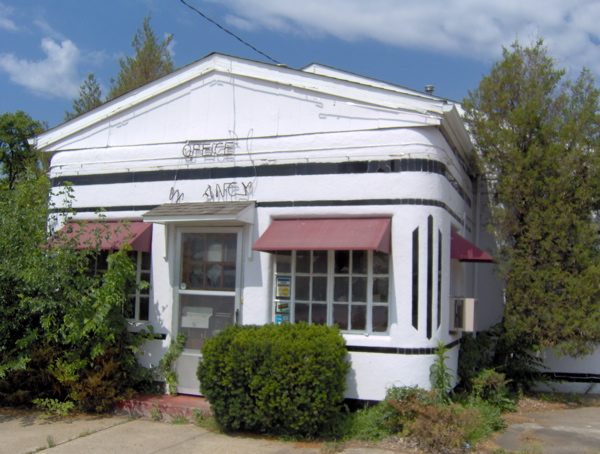
I also checked out the historic Boots Motel in Carthage, which was established in 1939, and was very modern for its time, with a radio, air conditioner and other amenities in every room. This property lies in thorough disrepair now:
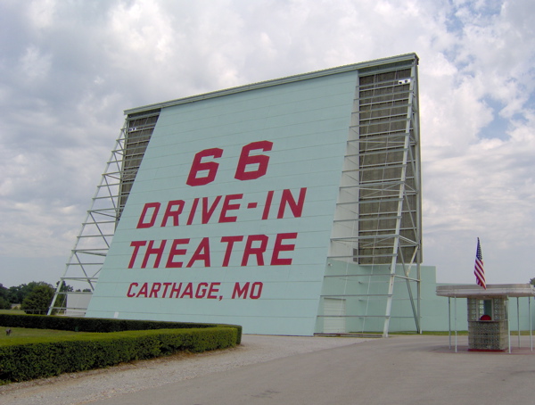
Also in Carthage is a recently restored Route 66 Drive-In movie theatre.
From Joplin, I started noticing a lot of Mexican restaurants, reflecting the changing demographics in my journey. After Joplin, Route 66 leaves Missouri and enters Kansas, where it stays for the very short distance of 13 miles. This part of Kansas, and the part of Oklahoma that 66 enters after it, is lead- and zinc-mining country. I stopped at the ancient Eisler Brothers Store (dating back to around 1925).
After leaving Kansas, I entered Oklahoma. Oklahoma has a central significance to Route 66. The man who was the force behind the conception and creation of Route 66, Cy Avery, was from Tulsa, Oklahoma, and he made sure the highway passed through his state and hometown, even though that is not the most direct route. But there’s more. Oklahoma was also the state that suffered the most during the dust storms I mentioned earlier, and the migrants in John Steinbeck’s Grapes of Wrath were Oklahomans. Finally, the chap who won the foot race I mentioned earlier was from Oklahoma. That foot race was a big, early step in putting Route 66 in people’s minds.
Oklahoma used to be Indian Territory until its statehood in 1907. In Oklahoma, I saw a lot of shops describing themselves as Indian trading posts, which is probably what they used to be in the old days (before credit cards). With Oklahoma I entered the Great American West. I’m hoping I will find the time to visit Monument Valley from Flagstaff, Arizona. From the pictures I’ve seen, Monument Valley is my favorite symbol of the Great American West.
In Oklahoma, my first stop was Miami, where I had lunch at Waylan’s Ku-Ku, an old Route 66 establishment. The bird on top of the building was at one time a working cuckoo clock.
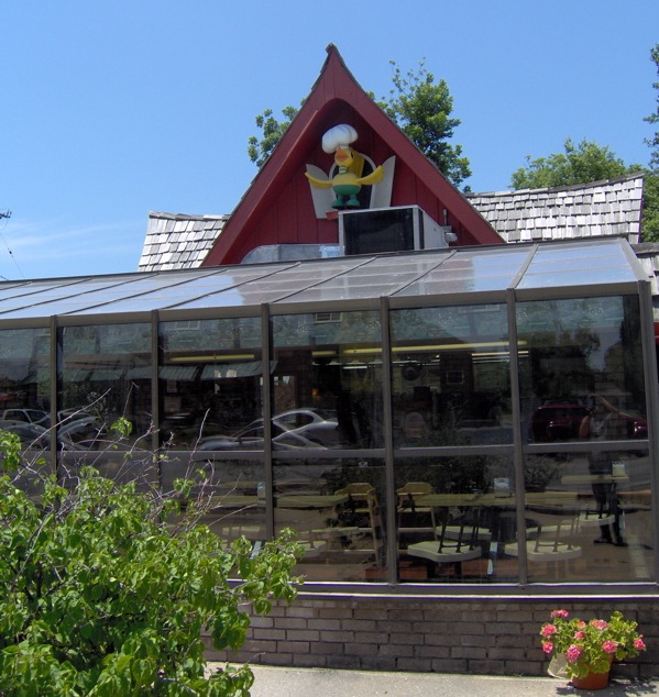
I thought lunch was delicious, but I was in for a much bigger treat soon after. This part of Oklahoma has preserved a few alignments of very, very old pavement, dating back to 1922, even before it was called Route 66. This pavement is just nine feet wide, and makes a somewhat rough and dusty drive today. I sought this out and drove on this historic section of Oklahoma road:
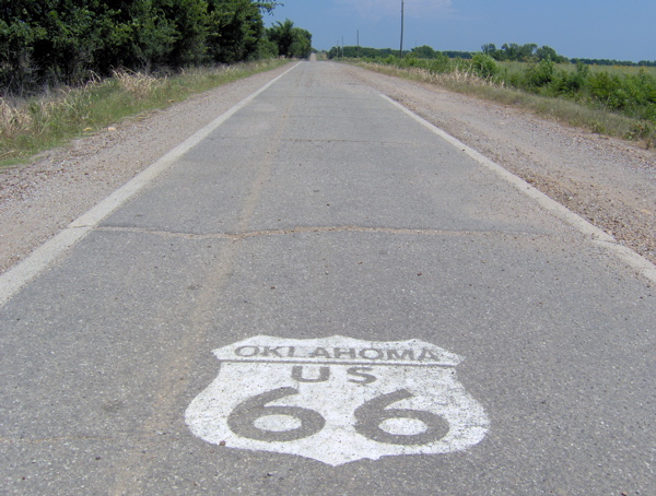
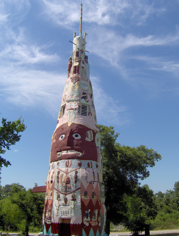
As you can see, there is only one lane, and there isn’t room for two vehicles side-by-side on this road. After this section ended, Route 66 acquired a very modern feel, because Oklahoma has turned it into a major four-lane transport corridor for a good distance. This is not much fun, but I stuck with it, passing through Vinita, Chelsea, Bushyhead, Foyil, Claremore, Verdigris and Catoosa.. In the old days, a drive on Route 66 used to be full of quirky, eccentric roadside attractions such as totem poles, reptile pits and other oddities and curiosities. Here’s a famous 90-foot totem pole that has been preserved near Foyil:
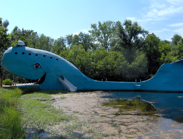
Another very famous but odd Route 66 attraction used to be the blue whale in Catoosa, popular with children. This was obviously before theme parks were invented. The whale has recently been re-opened, but not for use as diving board anymore:
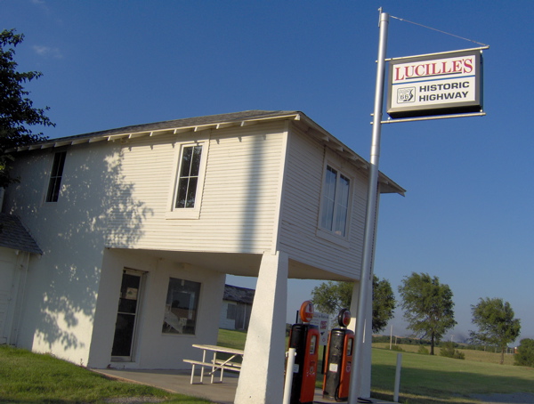
At Catoosa, I hopped on the interstate to speed my journey and got off at El Reno. Between El Reno and Hydro, I experienced the second highway treat of the day: miles and miles of pristine-condition 1933 concrete as it was laid down then, through quiet farmlands, and with the distinctive thud-thud noise signature caused by the old concrete sections. This was a super treat, which I enjoyed among the elongating shadows of the evening. Amazingly, I did not see a single soul in the fields or in the houses. At Hydro, I came to another Route 66 classic, Lucille’s gas station, dating back to 1941, but now shuttered. Lucille was Lucille Hamon, and she was known as the Mother of the Mother Road.
Near Hydro, and still in Oklahoma, is Clinton, where I’m staying for the night. Oklahoma is almost done, and tomorrow I will be in Texas. I’m glad I put in the effort to push through Oklahoma today, so I can again take it easy from tomorrow.
Day 3 on Route 66: Cutting through Missouri, St. Louis to Springfield
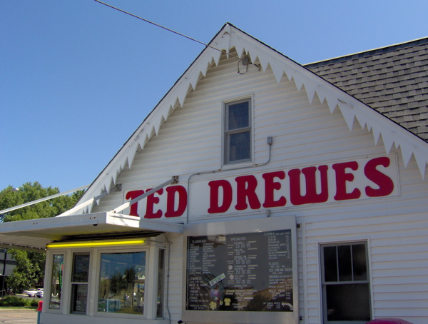
My day started where last night had ended, at St. Louis, Missouri. I spent the day following the diagonal path of Route 66 through this state. My Route 66 map for Missouri said “Routings through St. Louis are numerous and complex, and even after a process of elimination, choices must be made.” This opening line was daunting enough that I made the choice to take the freeway out of St. Louis, considering my tight schedule. But I did make one traditional Route 66 stop in St. Louis: Ted Drewes’ Frozen Custard. This Route 66 icon has been in operation since 1941 and is still very popular, as I could tell from the crowd on a Monday morning (not visible in the picture).
As I drove on the freeway tracking Route 66, I noticed that the north-south 55 interstate of the last two days had handed the baton to the east-west 44 in St. Louis. I also noticed that the last two days’ flat driving over the Illinois prairie had shifted to hilly ascents and descents. In the terrain map below, notice the change in terrain across the Illinois-Missouri border. This border is defined by the Mississippi River, which separates the Ozark Highlands of Missouri from the plains of Illinois.
I left the freeway at Stanton, gateway to the famous Meramec Caverns, another Route 66 staple for travelers in the 1930s. These are limestone caves that you can tour. They were aggressively marketed all over the Midwest by having the sides of barns painted with advertisements for this attraction, not just along Route 66, but other highways as well. Their clever marketer advertised the caverns as the former hideout of the outlaw Jesse James, despite the lack of strong supporting evidence. Soon, people far and wide had heard of the Meramec Caverns, and the caves became a veritable pilgrimage for (the gullible?) Route 66 travelers.
At Stanton, I got on to Route 66, and passed through numerous small towns again: Stanton, Sullivan, Bourbon, Cuba, Fanning, St. James, Doolittle, Clemetine, Hooker. Rolla was the one big town I passed through. Driving this section was like being on a gentle roller coaster ride, because the old road followed the ups and downs of the terrain, whereas the newer high-speed interstate system was built to grade out much of this variation for safer driving at high speeds. I could see this difference clearly as I compared my road with the interstate I was driving next to.
I sought out the “Devil’s Elbow” and drove on it. This is a now-bypassed section of Route 66 that is a bridge over a sharp bend in the river below. It was bypassed in the war years when transporting big military trucks through the sharp turn caused difficulties.
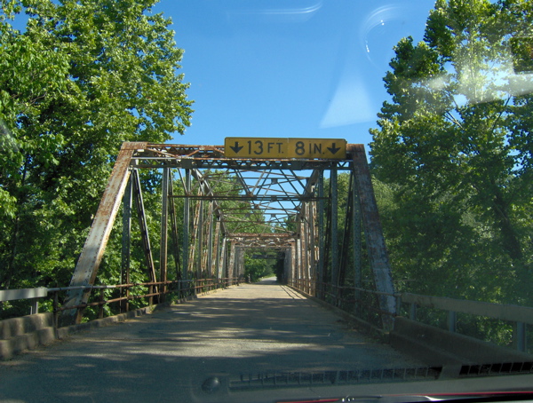
I took the freeway to Springfield, where I noticed a sign for a historical homestead site (the Nathan Boone Homestead). I took a detour to check out this potentially fascinating exhibit, but as I suspected, it was too late in the evening to visit it. It features a log cabin built in the late 1870s.
It was pretty late in the evening; the sun and elusiveness of Route 66 had worn me out. I couldn’t make it to Joplin, the last stop in Missouri, as I had planned, and took respite in the serendipitous discovery of a chain hotel while trying to sniff out Route 66 at Springfield.
Missouri hasn’t done nearly as good a job as Illinois with the road markings for Route 66, and today was rather hit-and-miss. If this keeps up, I’ll have to seek out just the easiest sections of Route 66 in each state. Tomorrow is big, because I will be driving in three states: Missouri, Kansas and Oklahoma.