[Account of May 30, 2011.]
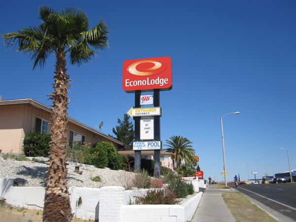
Route 66 has been retired by a set of interstate freeways: 55, 44, 40, 15, 10. At Barstow, the 40 freeway surrenders to the 15. Barstow sits at the corner of these two freeways and at the edge of the desert I have crossed. It is another one of those railroad towns on Route 66, along with Flagstaff, Williams, Kingman. I had checked into an EconoLodge that looked like a rebranded Route 66-era motel. Out at 9 am for a walk, I found the sun already high in the sky. But yesterday’s flat and featureless landscape had finally given way to some vegetation and highlands. Route 66 climbs an incline into town, with the EconoLodge near the summit.
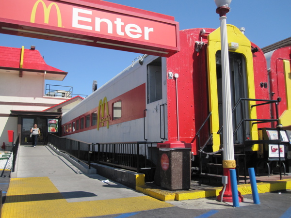
Downhill and to the east is a large McDonald’s built on a railroad theme. Their seating area is in an actual train carriage.
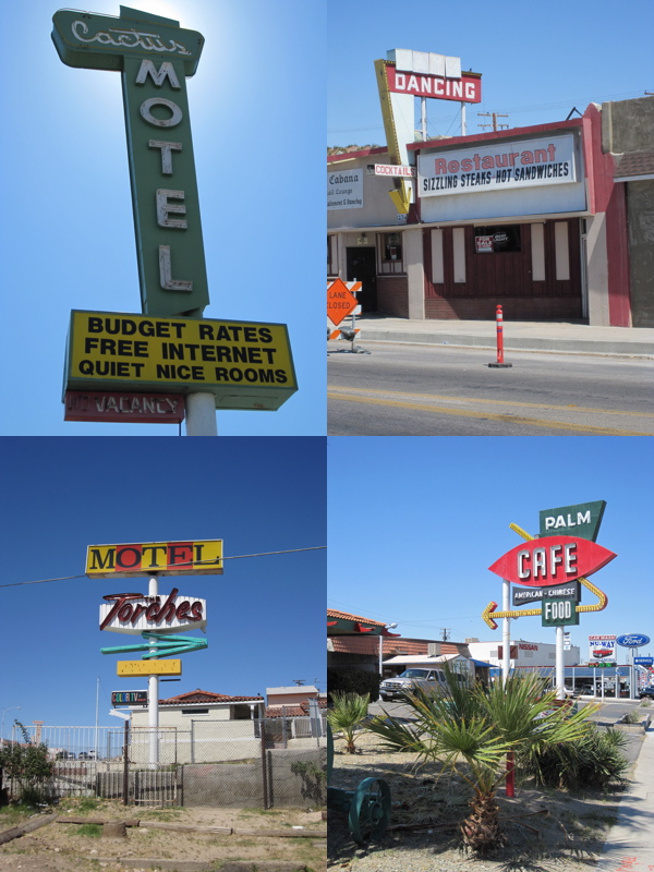
At Barstow, I am at the doorstep of the Los Angeles sprawl. There will be no more isolation on this route, no more amazement at the vacuum of a bypassed highway town. There was plenty of old neon in Barstow, but most of these establishments seemed to be still alive. Good for them.
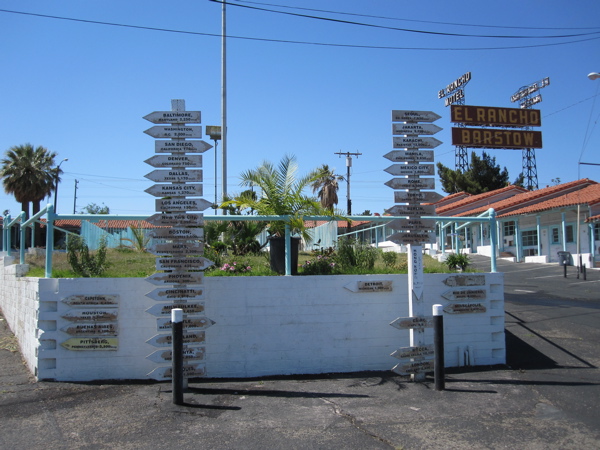
The El Rancho Barstow motel had a fine, if neglected, example of a large motor courtyard. I came across several other beautiful motel courtyards today on my drive through the Los Angeles metropolitan area. The decrepit El Rancho set the stage for these.
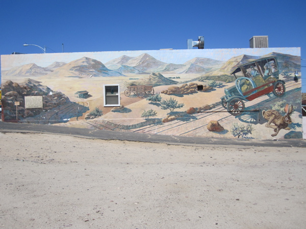
I found Barstow an interesting Route 66 town, as interesting as Tucumcari. Route 66 is alive here, but thankfully does not impose itself on you as it does in a town like Williams or Oatman. There are some beautiful murals along the route depicting the history of California. Here is one that talks about motorized westward migration starting in the 1920s.
The most interesting motel in Barstow is the Route 66 Motel. It is more museum than motel. The owner has taken great pains to preserve and depict scenes from the golden decades in this old establishment. Its garages house classic cars and odds-and-ends of the same age.

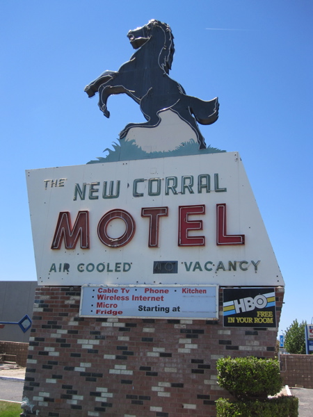
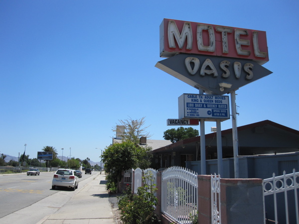
I had a very nice drive today. This was California, after all, the state where my experience of the U.S. was cemented. As I got closer to L.A., apartment blocks and street intersections took on a familiar character, and vague memories from nearly 11 years ago were triggered, from when these sunny scenes first flooded into and took seat in my consciousness. I drove through many towns in Los Angeles’ eastern hinterland on this typically sun-bathed Southern California day. It took me five hours more to push through the metropolitan traffic than I had estimated, but the drive was worth it. This was a very different experience of Los Angeles than when I had lived in it and driven on the freeways as often as I could. Once I got into the really dense and modern outskirts of L.A., it became difficult to spot much Route 66 signage, but before that there were quite a few treats, such as this flamboyant motel sign in Victorville.
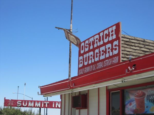
After Victorville, I had to hit the freeway for a while — instant shock after two days of laid-back backcountry driving. The San Bernardino mountains had some snow on their peaks, and got me wondering if that wouldn’t have been a welcome sign of cool weather for those who had made a hard desert crossing in their overheating trucks. Flagstaff was the other Route 66 town I could remember with a view of snow-clad peaks along the route. Lunch was off a freeway exit at the Summit Inn. This Route 66 diner has been in business since 1952. It is near the Cajon Summit, the last ascent for Route 66 travelers. This distinction must have been significant in the old days when the incline was a challenge. The Summit Inn still does great business. It houses numerous exhibits — old cars and trucks and gas station memorabilia. I passed on the ostrich burgers and ostrich egg omelettes (I think!) and had a regular omelette.
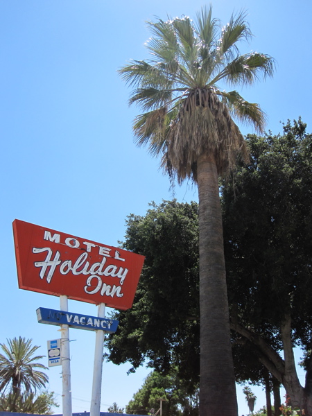
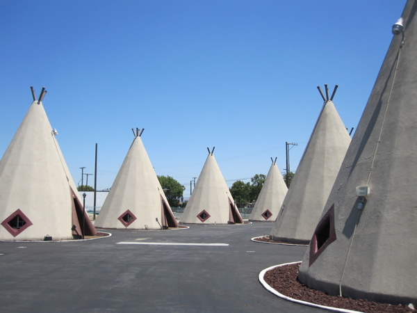
After another encounter with the freeway, I got off at San Bernardino and began my long slog through red lights on a straight stretch through north-eastern Los Angeles on what is now Foothill Blvd., Huntington Dr. and Colorado Blvd, passing through towns most of whose names I was familiar with from my L.A. days — San Bernardino, Rialto, Fontana, Rancho Cucamonga, Claremont, Glendora, Azusa, Duarte, Monrovia, Arcadia — before entering the outer orbit of my L.A. days in Pasadena. This day of driving was unlike any on Route 66. This was by far the most time I had spent in traffic and at red lights, and I haven’t even talked about driving in L.A. proper yet. But I greatly enjoyed the character nonetheless — palm trees and sun-themed motels abounded, as did beautiful motor courtyards. Here are two motels I found before I hit the prosperous parts.
In Rialto is the second Wigwam motel of Route 66. I saw the first one in Arizona back in 2009, and this one’s the second in this two-motel chain. This one is also renovated and in operation, and they seemed to be maintaining the property well.
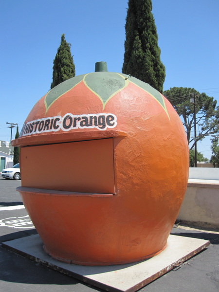
At Fontana is a historic orange-shaped stand that once dispensed orange juice and oranges, I guess. There used to be more of these along the streets in the heyday. This area of California was one-time epicenter of all things citrus. Fruit orchards are what drew so many of the Dust Bowl migrants, including John Steinbeck’s Okies in The Grapes of Wrath. Driving in these parts, I crossed several streets with fruit-themed names.
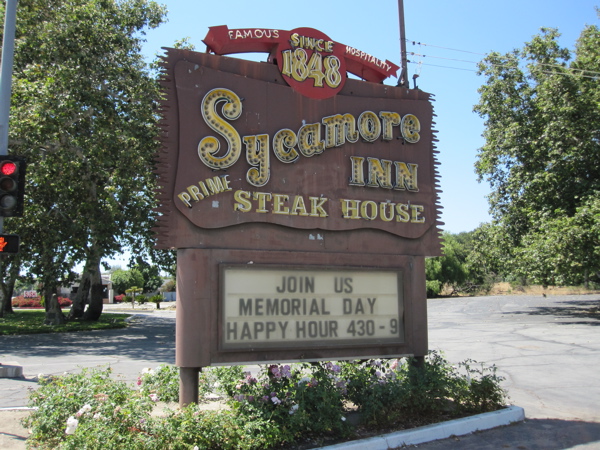
Once you cross Fontana, the neighborhoods look very well-maintained, with neat hedges and lush lawns lining the street. The lush vegetation glows healthfully in the warm sun, but many tree-shaded alcoves and benches promise cool resting places and perhaps the entertainment of a running fountain. This is the Southern California I remember so well. The town of Rancho Cucamonga oversees a very well-maintained stretch of Route 66, with large Route 66 shields painted on the street. In Rancho Cucamonga I stopped at the Sycamore Inn. This is a steakhouse dating back to the horse-carriage and Gold Rush era. It has been around since 1848, as the sign says. I took a short walk on its large empty grounds, imagined the clatter of horse carriages turning into the yard and wondered if any of the large trees had been around in the days of the Gold Rush.
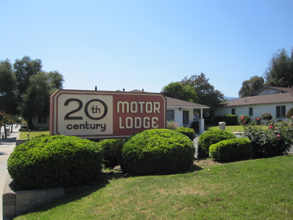
On the rest of my westward drive, I occasionally came across interesting signage. Unlike in the concentrated areas of Albuquerque, Tucumcari and Barstow, the signs here popped up occasionally and were spread over this large distance, so I stopped only for the ones that I found most compelling. Here is one in Glendora that I found extremely beautiful. It represented, no doubt, cutting-edge design aesthetics in its day. “20th century” was no empty boast, I’m sure. The grounds were groomed very well and the architectural design was very Californian; I would love to stay here someday.
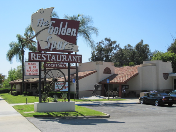
Further west was the sign for the Golden Spur restaurant, another one that had eye-catching appeal and an instant evocativeness of a different aesthetic.
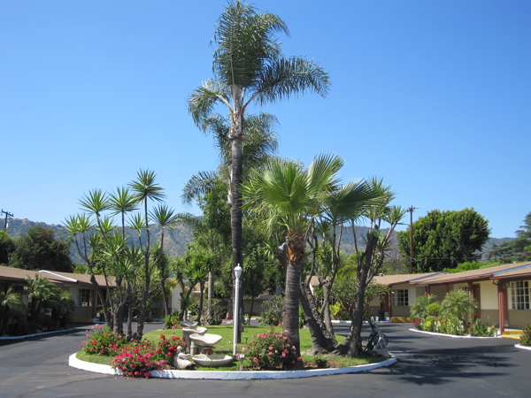
Also in Glendora I came across the splendid, inviting, sun-drenched courtyard of a motel called the Palm Tropics Motel. This courtyard displayed so much that I enjoyed about today’s drive — palm trees glinting in the sun, open space, room for cars.
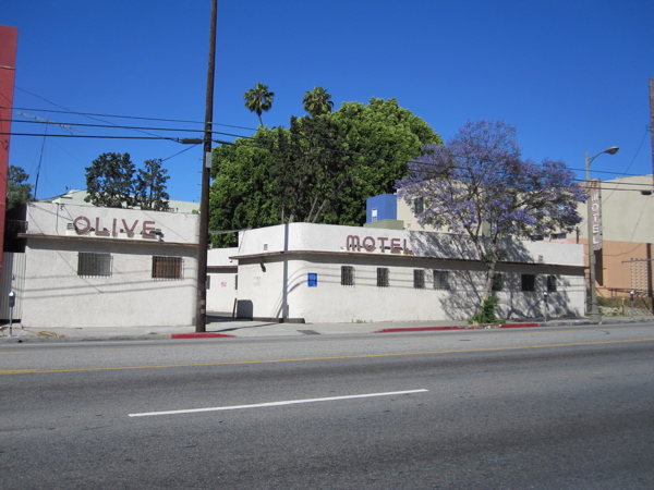
After an epic drive through the towns I mentioned before, I finally hit and traversed familiar Pasadena, and took the 110 down to Sunset and Santa Monica Blvd. Los Angeles, old friend! On Sunset, in the Silver Lake neighborhood, I drove past a motel that just compelled me to make a U-turn and come back to it. The rounded corners are representative of the Streamline Moderne style, and the lettering of the words “Olive Motel” was in perfect harmony with the building. The picture does not do it justice. It seems this motel is now pretty run-down and questionable.
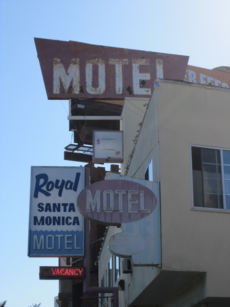
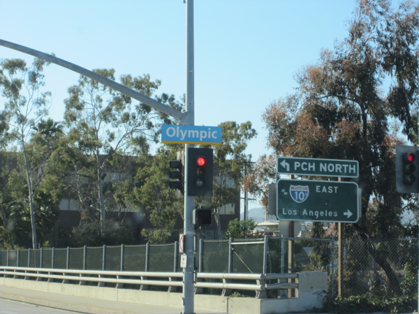
I was almost at my destination now. According to my guide book, Route 66 officially ends at the intersection of Lincoln and Olympic, a crossing whose current distinction is solely as your crowded gateway to the eastbound 10 back to Los Angeles after your day on the beach. The unofficial end of Route 66 is a little distance away at the Santa Monica Pier. I drove westbound on Santa Monica towards these two destinations for a crawling hour. The last Route 66 motel that I stopped to photograph was one that I had actually stayed at on a previous trip to L.A. At that time I didn’t realize the significance of its location. That brought to four my tally of motels along Route 66 I have stayed at — along with the ones in Tucumcari, Kingman and Barstow.
It was Memorial Day, and I was headed to the ever-popular Santa Monica in west L.A. on a very sunny day. The traffic seemed Kafkaesque, and I was immediately reminded of my struggles with pedestrian and vehicular traffic in the urban maze corresponding to the other end of Route 66 — Chicago. I managed to crawl to the official end of Route 66 at the intersection of Lincoln and Olympic. Deciding I could not afford to spend an hour finding a place to park and walking to the spot and then back, I did a drive-by ending of my Route 66 journey.
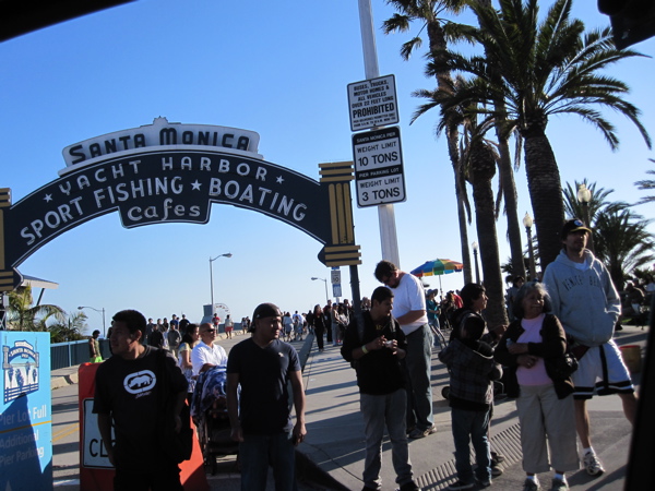
That left the unofficial end of the route at the edge of the ocean on Santa Monica Pier. Once I hit those parts, I had to contend not only with bumper-to-bumper traffic, but also thick streams of hundreds of people flowing into the street and clogging the intersections. It was 6:30 pm, my flight back home was at 9:30 pm, and I still had to meet my friends and get to the airport. So the unofficial end to the journey I started two years ago and enjoyed so much was also experienced through the window of my car as I drove past.
I dropped my rental car off after putting 731 miles and an alarming high-pitched whining sound on it. My souvenir from this trip is a bottle of root beer I bought at Roy’s in Amboy — it’s sold as “Route Beer”, and has the Route 66 logo all over it..
So it ends, as it began among a crowd of pedestrians. How do you know, I wonder, which signage is vintage? I would have assumed the owners just had bad/odd/old-fashioned taste!
gcst28
uxodh5
n3glan